
IMAGES TAKEN NEAR TO
Amington Road, BIRMINGHAM, B25 8ET
Introduction
This page details the photographs taken nearby to Amington Road, B25 8ET by members of the Geograph project.
The Geograph project started in 2005 with the aim of publishing, organising and preserving representative images for every square kilometre of Great Britain, Ireland and the Isle of Man.

There are currently over 7.5m images from over14,400 individuals and you can help contribute to the project by visiting https://www.geograph.org.uk
Image Map
Images are licensed for reuse under creativecommons.org/licenses/by-sa/2.0
Notes
- Clicking on the map will re-center to the selected point.
- The higher the marker number, the further away the image location is from the centre of the postcode.
Image Listing (21 Images Found)
Images are licensed for reuse under creativecommons.org/licenses/by-sa/2.0
Image
Details
Distance
1
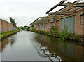
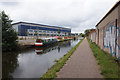
Derelict canalside factory near Tyseley, Birmingham
There is no roof on the works to the right. However, it is still, apparently, being used for open air storage.
Image: © Roger D Kidd
Taken: 21 Aug 2012
0.03 miles
2
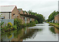
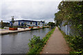
Derelict canalside factory near Tyseley, Birmingham
There is no roof on much of the works to the left. However, the shell is still, apparently, being used for open air storage.
Image: © Roger D Kidd
Taken: 29 Aug 2012
0.03 miles
3
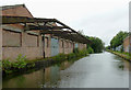
Derelict canalside factory near Tyseley, Birmingham
There is no roof on much of the works to the left. However, the shell is still, apparently, being used for open air storage.
Image: © Roger D Kidd
Taken: 29 Aug 2012
0.04 miles
4
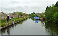
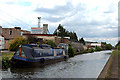
Grand Union Canal near Tyseley, Birmingham
Formerly the Warwick and Birmingham Canal.
The area is smothered in industry, at Hay Mills off to the left, and Tyseley off to the right. Most canal-side factories are either derelict, demolished, or are now cut off from all previous wharfs. New units are being built, many not showing yet on maps or available satellite images of the area.
Image: © Roger D Kidd
Taken: 21 Aug 2012
0.04 miles

7
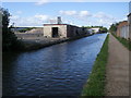
Grand Union Canal Walk
Grand Union Canal Walk by the remains of the Birmingham Truck Stop
Image: © Shaun Ferguson
Taken: 16 Sep 2016
0.05 miles
10
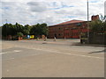
Hay Mills Fire Station, Birmingham
This area of Birmingham is highly industrialised. The location of this Fire Station, amongst such a high density of industrial units, is probably very strategic.
Image: © John Evans
Taken: 27 Aug 2006
0.09 miles