
IMAGES TAKEN NEAR TO
Durley Road, BIRMINGHAM, B25 8EE
Introduction
This page details the photographs taken nearby to Durley Road, B25 8EE by members of the Geograph project.
The Geograph project started in 2005 with the aim of publishing, organising and preserving representative images for every square kilometre of Great Britain, Ireland and the Isle of Man.

There are currently over 7.5m images from over14,400 individuals and you can help contribute to the project by visiting https://www.geograph.org.uk
Image Map
Images are licensed for reuse under creativecommons.org/licenses/by-sa/2.0
Notes
- Clicking on the map will re-center to the selected point.
- The higher the marker number, the further away the image location is from the centre of the postcode.
Image Listing (30 Images Found)
Images are licensed for reuse under creativecommons.org/licenses/by-sa/2.0
Image
Details
Distance
1
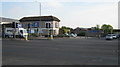
Dolland and Aitchison, Coventry Road
On main dual carriageway, opposite the recreation ground, offices and factory of opticians, now part of Boots
Image: © Michael Westley
Taken: 4 May 2011
0.13 miles
2

Birmingham : Coventry Road A45
At the traffic lights along Coventry Road.
Image: © Lewis Clarke
Taken: 1 Jul 2015
0.16 miles
3

Old Bill and Bull
Large public house, converted from former police station on main A45 Coventry Road, near Yardley
Image: © Michael Westley
Taken: 4 May 2011
0.18 miles
4

OS benchmark - Hay Mills, former police station
This OS cutmark lies beside the front door of the former Hay Mills police station, which has now been converted into the Old Bill and Bull pub. It was originally levelled in 1965 at 126.03m above Ordnance Datum Newlyn.
Image: © Richard Law
Taken: 24 Nov 2014
0.18 miles
5
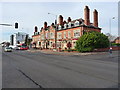
The Old Bill and Bull
This pub on the corner of Holder Road takes at least part of its name from the fact that it was formerly a police station, though it's not so clear where the 'Bull' part comes from.
Image: © Richard Law
Taken: 24 Nov 2014
0.18 miles
6
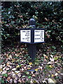
Canalside distance post - Stockfield Road bridge
One of several such distance posts that have recently been installed along the towpath. It's tempting to describe them as mileposts, but they're not - all the distances are quoted in metres and kilometres, units that would have been unknown at the time to the builders of the canal.
Image: © Richard Law
Taken: 27 Oct 2014
0.20 miles
7
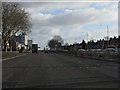
Coventry Road (A45) at Holder Road traffic lights
Image: © Peter Whatley
Taken: 7 Dec 2011
0.20 miles
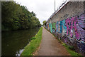
9
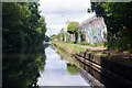
Grand Union Canal, South Yardley
This is the view along the canal from just west of bridge 87 towards central Birmingham. The wall beside the towpath is well armoured.
Image: © Stephen McKay
Taken: 6 Aug 2024
0.20 miles
10
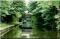
Grand Union Canal near Tyseley, Birmingham
Approaching Stockfield Road Bridge, No 87.
Image: © Roger D Kidd
Taken: 21 Aug 2012
0.20 miles