
IMAGES TAKEN NEAR TO
Deakins Road, BIRMINGHAM, B25 8EA
Introduction
This page details the photographs taken nearby to Deakins Road, B25 8EA by members of the Geograph project.
The Geograph project started in 2005 with the aim of publishing, organising and preserving representative images for every square kilometre of Great Britain, Ireland and the Isle of Man.

There are currently over 7.5m images from over14,400 individuals and you can help contribute to the project by visiting https://www.geograph.org.uk
Image Map
Images are licensed for reuse under creativecommons.org/licenses/by-sa/2.0
Notes
- Clicking on the map will re-center to the selected point.
- The higher the marker number, the further away the image location is from the centre of the postcode.
Image Listing (10 Images Found)
Images are licensed for reuse under creativecommons.org/licenses/by-sa/2.0
Image
Details
Distance
1

Surgery, Coventry Road, Hay Mills, Birmingham
Disused Surgery
Image: © user
Taken: 2 Oct 2011
0.16 miles
2
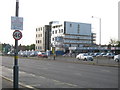
Redevelopment, Coventry Road
New / redesigned offices on north side of Coventry Road, dual carriageway
Image: © Michael Westley
Taken: 4 May 2011
0.17 miles
3
Birmingham : Coventry Road A45
A road heading along through Birmingham.
Image: © Lewis Clarke
Taken: 1 Jul 2015
0.19 miles
4
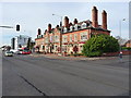
The Old Bill and Bull
This pub on the corner of Holder Road takes at least part of its name from the fact that it was formerly a police station, though it's not so clear where the 'Bull' part comes from.
Image: © Richard Law
Taken: 24 Nov 2014
0.20 miles
5

OS benchmark - Hay Mills, former police station
This OS cutmark lies beside the front door of the former Hay Mills police station, which has now been converted into the Old Bill and Bull pub. It was originally levelled in 1965 at 126.03m above Ordnance Datum Newlyn.
Image: © Richard Law
Taken: 24 Nov 2014
0.21 miles
6

Old Bill and Bull
Large public house, converted from former police station on main A45 Coventry Road, near Yardley
Image: © Michael Westley
Taken: 4 May 2011
0.21 miles
7
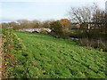
Footbridge over the River Cole
A narrow (foot-only) bridge over the Cole, between the Hay Barn Recreation Grounds and the estates of Hay Mills and Yardley.
Image: © Richard Law
Taken: 24 Nov 2014
0.23 miles
8

Birmingham : Coventry Road A45
At the traffic lights along Coventry Road.
Image: © Lewis Clarke
Taken: 1 Jul 2015
0.23 miles
9
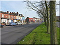
Shops and houses, Coventry Road
Parade of small shops and residences on the north side of the main A45 Coventry Road out of Birmingham.
Image: © Richard Law
Taken: 24 Nov 2014
0.23 miles
10

Recreation Ground, Yardley
Large L-shaped rec ground, accessed and viewed here from Coventry Road, looking north, near former tennis courts
http://www.birminghammail.net/what-is-on-in-birmingham/birmingham-days-out/2011/03/25/walk-in-the-park-oakland-recreation-ground-yardley-b26-97319-28399423/
Image: © Michael Westley
Taken: 4 May 2011
0.24 miles