
IMAGES TAKEN NEAR TO
Milwards End, BIRMINGHAM, B23 7BF
Introduction
This page details the photographs taken nearby to Milwards End, B23 7BF by members of the Geograph project.
The Geograph project started in 2005 with the aim of publishing, organising and preserving representative images for every square kilometre of Great Britain, Ireland and the Isle of Man.

There are currently over 7.5m images from over14,400 individuals and you can help contribute to the project by visiting https://www.geograph.org.uk
Image Map
Images are licensed for reuse under creativecommons.org/licenses/by-sa/2.0
Notes
- Clicking on the map will re-center to the selected point.
- The higher the marker number, the further away the image location is from the centre of the postcode.
Image Listing (33 Images Found)
Images are licensed for reuse under creativecommons.org/licenses/by-sa/2.0
Image
Details
Distance
1
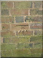
OS benchmark - Upper Witton, cemetery wall
An OS cutmark on the wall of the Birmingham City (Witton) Cemetery; it's marked on the map of 1884, so fair to assume it was cut as part of the first Primary Levelling survey of England and Wales between 1840 & 1860. The height is given on the older maps as variously 374.3 feet, 374.7 feet and 374.8 feet above Liverpool Datum. There is another, very similar mark 440 yards north of here at Image
Image: © Richard Law
Taken: 9 Aug 2018
0.09 miles
2
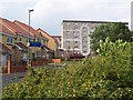
Wyrley Birch
The housing blocks of Wyrley Birch are visible throughout the surrounding area but this was the first time I'd found the road that goes right up to them. It's often cited as a "problem estate" and maybe its inaccessibility is part of the problem. But it's in a nice location; behind me when I took this shot were the lakes and park.
Image: © Adrian Bailey
Taken: 14 Jul 2005
0.10 miles
3
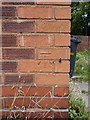
OS benchmark - Upper Witton, 153 Gipsy Lane
An OS cutmark on the front wall of no 153 Gipsy Lane; originally levelled, probably in 1956, at 103.37m above Ordnance Datum Newlyn.
Image: © Richard Law
Taken: 9 Aug 2018
0.12 miles
4
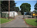
Garages and containers, Witton Cemetery B23
A work area near the entrance on The Ridgeway.
Image: © Robin Stott
Taken: 10 Aug 2012
0.15 miles
5
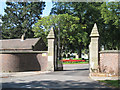
Witton Cemetery, eastern entrance, The Ridgeway B23
Image: © Robin Stott
Taken: 10 Aug 2012
0.16 miles
6
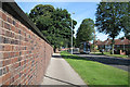
The Ridgeway B23 past Witton Cemetery
The cemetery's eastern boundary by The Ridgeway is 1·3 kilometres long.
Image: © Robin Stott
Taken: 10 Aug 2012
0.16 miles

8
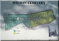
Plan of Witton Cemetery B23
This plan is near the entrance on The Ridgeway. Note the orientation: the cemetery is aligned more NNW-SSE.
Image: © Robin Stott
Taken: 10 Aug 2012
0.17 miles
9
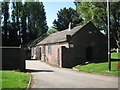
Sheds, Witton Cemetery B23
Inside the entrance off The Ridgeway.
Image: © Robin Stott
Taken: 10 Aug 2012
0.18 miles
10
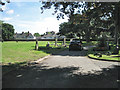
Driving around in Witton Cemetery
Getting around by car in a cemetery always seems to me to be a bit disrespectful but, given the size of a place like Witton (105 acres/40 hectares), I suppose it's not unreasonable. After all, these big Victorian cemeteries were laid out for horse-drawn carriages, hearses and carts.
Image: © Robin Stott
Taken: 10 Aug 2012
0.19 miles