
IMAGES TAKEN NEAR TO
Church Lane, BIRMINGHAM, B20 2RT
Introduction
This page details the photographs taken nearby to Church Lane, B20 2RT by members of the Geograph project.
The Geograph project started in 2005 with the aim of publishing, organising and preserving representative images for every square kilometre of Great Britain, Ireland and the Isle of Man.

There are currently over 7.5m images from over14,400 individuals and you can help contribute to the project by visiting https://www.geograph.org.uk
Image Map
Images are licensed for reuse under creativecommons.org/licenses/by-sa/2.0
Notes
- Clicking on the map will re-center to the selected point.
- The higher the marker number, the further away the image location is from the centre of the postcode.
Image Listing (32 Images Found)
Images are licensed for reuse under creativecommons.org/licenses/by-sa/2.0
Image
Details
Distance
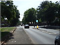
1
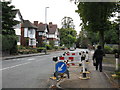
Church Lane, Handsworth
Elegant suburbia.
Image: © Peter Whatley
Taken: 2 Oct 2008
0.05 miles
2
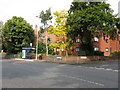
Junction of Church Lane and Selbourne Road
Image: © Peter Whatley
Taken: 2 Oct 2008
0.07 miles
4
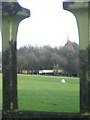
Handsworth Park through railings
View from Hinstock Road, Handsworth, into the park in direction of (and can see) the footbridge across the railway that joins the two sections of the park.
Image: © Michael Westley
Taken: 17 Jan 2010
0.12 miles
6
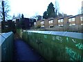
Footbridge across railway at Handsworth
Ahead are houses in Bromford Close off Church Lane, Handsworth. The footbridge crosses the railway line and joins the two sections of Handsworth Park. To the right is the site of former Handsworth Wood Station. To the left is the smooth curve around towards Soho Road.
Image: © Michael Westley
Taken: 17 Jan 2010
0.13 miles
8
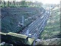
Handsworth Wood Station (site of)
View of station site from Hamstead Road (through railings), showing clearly, on left the line of footpath that once took passengers down to platforms. In distance is the footbridge that joins the two parts of Handsworth Park.
See http://www.railaroundbirmingham.co.uk/Stations/handsworth_wood.php for photo of station and further details.
Image: © Michael Westley
Taken: 17 Jan 2010
0.15 miles
9
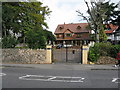
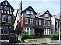
House on Church Lane, Handsworth
A striking house, prominently dated 2002, with stone lions perched behind metal cages atop the gateposts.
Image: © Peter Whatley
Taken: 2 Oct 2008
0.16 miles
10
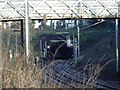
Footbridge and Tunnel entrance, Handsworth Wood
View from Handsworth Park of footbridge across the line, and the tunnel entrance in distance. This is the site of former Handsworth Wood Station. The railway line is principally a freight line, but also has Birmingham - Walsall passenger services running through, though there are no longer any stations between Smethwick Rolfe Street and Hamstead.
See http://www.railaroundbirmingham.co.uk/Stations/handsworth_wood.php for further details and old photo.
Image: © Michael Westley
Taken: 17 Jan 2010
0.16 miles