
IMAGES TAKEN NEAR TO
Hall Road, BIRMINGHAM, B20 2BB
Introduction
This page details the photographs taken nearby to Hall Road, B20 2BB by members of the Geograph project.
The Geograph project started in 2005 with the aim of publishing, organising and preserving representative images for every square kilometre of Great Britain, Ireland and the Isle of Man.

There are currently over 7.5m images from over14,400 individuals and you can help contribute to the project by visiting https://www.geograph.org.uk
Image Map
Images are licensed for reuse under creativecommons.org/licenses/by-sa/2.0
Notes
- Clicking on the map will re-center to the selected point.
- The higher the marker number, the further away the image location is from the centre of the postcode.
Image Listing (49 Images Found)
Images are licensed for reuse under creativecommons.org/licenses/by-sa/2.0
Image
Details
Distance
1
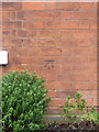
OS benchmark - Gib Heath, 65 Villa Road
An OS cutmark on what was, once upon a time, a house at 65 Villa Road. It's now a small mosque. The mark was originally levelled in 1949 at 132.704m above Ordnance Datum Newlyn.
Image: © Richard Law
Taken: 1 Feb 2017
0.05 miles
2
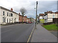
Villa Road, Handsworth
Looking towards the Hamstead Road cross at a set of lights 150 yards away.
Image: © Richard Law
Taken: 1 Feb 2017
0.06 miles
3

Asian Resource Centre, Hamstead Road
Renovations in progress of building on corner of Hamstead Road and Villa Road.
Image: © Michael Westley
Taken: 17 Jan 2010
0.06 miles
4
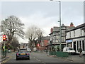
Hamstead Road Lozells Approaching Villa Road Crossroad
Image: © Roy Hughes
Taken: 25 Dec 2017
0.06 miles
5
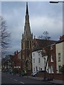
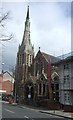
Hamstead Road Baptist Church, Handsworth
Image: © Geoff Pick
Taken: 11 Jan 2011
0.09 miles
9
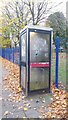
Telephone Kiosk on Hampstead Road
This telephone kiosk stands on the west side of Hamstead Road at the junction of Broughton Road. When the photograph was taken the kiosk looked rather neglected and one wonders if its days are numbered.
Image: © Paul Collins
Taken: 8 Nov 2016
0.14 miles
10
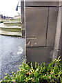
OS benchmark - Gib Heath, entrance to King Edward VI school
An OS cutmark on the sandstone doorway at the main entrance to the King Edwards VI girls' school (which is unphotographed at present); the mark was originally levelled at 139.467m above Ordnance Datum Newlyn.
Image: © Richard Law
Taken: 1 Feb 2017
0.15 miles