IMAGES TAKEN NEAR TO
Roland Gardens, BIRMINGHAM, B19 1RH

Introduction

This page details the photographs taken nearby to Roland Gardens, B19 1RH by members of the Geograph project.

The Geograph project started in 2005 with the aim of publishing, organising and preserving representative images for every square kilometre of Great Britain, Ireland and the Isle of Man.

There are currently over 7.5m images from over14,400 individuals and you can help contribute to the project by visiting https://www.geograph.org.uk

Image Map


Images are licensed for reuse under creativecommons.org/licenses/by-sa/2.0
Notes
  • Clicking on the map will re-center to the selected point.
  • The higher the marker number, the further away the image location is from the centre of the postcode.

Image Listing (15 Images Found)

Images are licensed for reuse under creativecommons.org/licenses/by-sa/2.0
Image
Details
Distance
1
"The Stork Inn" on Heathfield Road
Image: © Neil Theasby Taken: 19 Oct 2014
0.13 miles
2
Birchfield Road into Birmingham
Image: © Steve Daniels Taken: 6 Apr 2014
0.17 miles
3
Community Roots mural
Painted onto the gable of the first house on Wilson Road, this is the counterpoint to Image on the house on the other side of the street
Image: © Richard Law Taken: 1 Feb 2017
0.18 miles
4
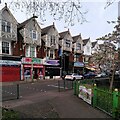
Corner of Lozells Road and Carpenter Road
A distinctive row of houses on Lozells Road (Image]) is viewed from beside the community garden at the corner of Carpenter Road, a sign of mutual aid and resilience.
Image: © A J Paxton Taken: 22 Apr 2023
0.19 miles
5
Community Roots
Image: © Row17 Taken: 9 Jun 2011
0.19 miles
6
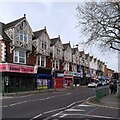
137-159 Lozells Road, Birmingham
This is a very striking row of twelve three-storey shops with housing over. The top floor of each house has a gable end overhanging the road on brackets and decorated with timber-framing and barge-boards; a touch of Merrie England in Handsworth. They look late 19th or early 20th century, and resemble the 1904 row on Smethwick High Street (Image]), though those lack the overhanging gables.
Image: © A J Paxton Taken: 22 Apr 2023
0.19 miles
7
Houses on Church Hill Road, Birchfield
1920s or 1930s houses on the north side of Birmingham.
Image: © Richard Law Taken: 1 Feb 2017
0.21 miles
8
Berners Street, Lozells
Image: © Chris Whippet Taken: 29 Dec 2013
0.22 miles
9
St. Paul's church in Lozells
This building may no longer be church. Being where it is it could be anything from a cash-and-carry to a temple. A sign nearby indicated that part of it is being used as a child day-care centre. The category of church has only been used for want of a better description.
Image: © Row17 Taken: 9 Jun 2011
0.23 miles
10
Along Lozells Road
Looking west along Lozells Road, in the general direction of the main A34 running north from the city centre through to the M6 at junction 7
Image: © Richard Law Taken: 1 Feb 2017
0.24 miles