IMAGES TAKEN NEAR TO
Coplow Street, BIRMINGHAM, B16 0DG
Introduction
This page details the photographs taken nearby to Coplow Street, B16 0DG by members of the Geograph project.
The Geograph project started in 2005 with the aim of publishing, organising and preserving representative images for every square kilometre of Great Britain, Ireland and the Isle of Man.

There are currently over 7.5m images from over14,400 individuals and you can help contribute to the project by visiting https://www.geograph.org.uk
Image Map
Images are licensed for reuse under creativecommons.org/licenses/by-sa/2.0
Notes
- Clicking on the map will re-center to the selected point.
- The higher the marker number, the further away the image location is from the centre of the postcode.
Image Listing (182 Images Found)
Images are licensed for reuse under creativecommons.org/licenses/by-sa/2.0
Image
Details
Distance

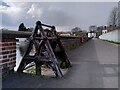
2
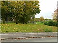
Northern end of the Harborne Walkway
The gently curving alignment is the only feature to indicate that this was once a railway line, which actually ran in a cutting that has been completely filled in. This was the branch to Harborne.
Image: © Alan Murray-Rust
Taken: 21 Oct 2015
0.10 miles
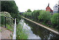
6
Along the dam, Edgbaston Reservoir
This is a view from the footpath across the dam, looking north towards the buildings by the Midlands Sailing Club. The reservoir was built in the 1820s by Thomas Telford to supply water to canals.
Image: © A J Paxton
Taken: 2 Apr 2022
0.13 miles
9
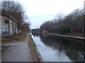
Canal from Birmingham towards Wolverhampton
Image: © David Smith
Taken: 17 Mar 2010
0.13 miles
10
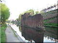
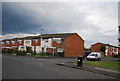
No longer in use
This bridge pier used to carry the LMS railway branch line to Harborne. As far as I know the line was closed in the Beeching era, but I remember it well before that and cannot ever remember the line in use. Most of the old railway line is now a linear park. The houses in the upper right hand corner are in Northbrook Street.
Image: © Row17
Taken: 6 May 2008
0.13 miles