1
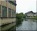
Port / Loop
Part of the Port Loop housing development by Urban Splash and other partners, on land enclosed by the BCN's Icknield Port Loop.
Image: © Christine Johnstone
Taken: 9 May 2022
0.02 miles
2
Old Tube Works, Rotton Park Street
This disused site was once a tube works in a very industrialised area. It awaits a new life as 'The Tubeworks', part of the Icknield Port Loop regeneration which comprises a new 43-acre neighbourhood, including over 1100 homes, a community hub, commercial office spaces, a new leisure centre and a swimming pool.
Image: © Paul Collins
Taken: 3 Jul 2022
0.02 miles
3
Icknield Port Loop near Rotton Park, Birmingham
Looking south-west towards Icknield Port Road Bridge and Osler Street.
This loop is a remnant of the original meandering contour-hugging main line to Wolverhampton, which was built under supervision of James Brindley during 1768-1772. It is still used as a feeder channel from Edgbaston Reservoir to provide water for the new main line, engineered by Thomas Telford, and completed in stages between 1824 and (posthumously) 1838. https://en.wikipedia.org/wiki/Icknield_Port_Loop
Very dull weather, hence disappointingly dull image! :-(
Image: © Roger Kidd
Taken: 26 Aug 2010
0.02 miles
4
Icknield Port Loop near Rotton Park, Birmingham
Looking south-west towards Icknield Port Road Bridge and Osler Street.
This loop is a remnant of the original meandering contour-hugging main line to Wolverhampton, which was built under supervision of James Brindley during 1768-1772. It is still used as a feeder channel from Edgbaston Reservoir to provide water for the new main line, engineered by Thomas Telford, and completed in stages between 1824 and (posthumously) 1838.
https://en.wikipedia.org/wiki/Icknield_Port_Loop
Image: © Roger Kidd
Taken: 26 Aug 2010
0.03 miles
5
Old Tube Works, Rotton Park Street
This disused site was a tube works in a previously very industrialised area. It awaits a new life as 'The Tubeworks', part of the Icknield Port Loop regeneration which comprises a new 43-acre neighbourhood, including over 1100 homes, a community hub, commercial office spaces, a new leisure centre and a swimming pool.
Image: © Paul Collins
Taken: 3 Jul 2022
0.03 miles
6
Icknield Port Loop near Rotton Park, Birmingham
Looking west-south-west towards Osler Street Bridge (which actually carries Icknield Port Road).
This loop is a remnant of the original meandering contour-hugging main line to Wolverhampton, which was built under supervision of James Brindley during 1768-1772. It is still used as a feeder channel from Edgbaston Reservoir to provide water for the new main line, engineered by Thomas Telford, and completed in stages between 1824 and (posthumously) 1838. https://en.wikipedia.org/wiki/Icknield_Port_Loop
Very dull weather, hence disappointingly dull image! :-(
Image: © Roger Kidd
Taken: 26 Aug 2010
0.04 miles
7
Icknield Port loop of the Birmingham Canal Navigations Main Line
Image: © Mat Fascione
Taken: 17 Nov 2020
0.04 miles
8
Icknield Port Road Bridge near Rotton Park, Birmingham
Looking west towards Icknield Port Road Bridge (sometimes marked as Osler Street Bridge).
Birmingham Canal Navigations. This loop is a remnant of the original meandering contour-hugging main line to Wolverhampton, which was built under supervision of James Brindley during 1768-1772. It is still used as a feeder channel from Edgbaston Reservoir to provide water for the new main line, engineered by Thomas Telford, and completed in stages between 1824 and (posthumously) 1838.
Image: © Roger Kidd
Taken: 26 Aug 2010
0.04 miles
9
Icknield Port Loop near Rotton Park, Birmingham
Looking east-north-east from near Osler Street Bridge (which actually carries Icknield Port Road).
This loop is a remnant of the original meandering contour-hugging main line to Wolverhampton, which was built under supervision of James Brindley during 1768-1772. It is still used as a feeder channel from Edgbaston Reservoir to provide water for the new main line, engineered by Thomas Telford, and completed in stages between 1824 and (posthumously) 1838.
https://en.wikipedia.org/wiki/Icknield_Port_Loop
Image: © Roger Kidd
Taken: 26 Aug 2010
0.04 miles
10
Icknield Port Loop near Rotton Park, Birmingham
Looking south-west towards Icknield Port Road Bridge and Osler Street.
This loop is a remnant of the original meandering contour-hugging main line to Wolverhampton, which was built under supervision of James Brindley during 1768-1772. It is still used as a feeder channel from Edgbaston Reservoir to provide water for the new main line, engineered by Thomas Telford, and completed in stages between 1824 and (posthumously) 1838.
Very dull drizzly day - hence lower quality image :-(
Image: © Roger Kidd
Taken: 26 Aug 2010
0.04 miles


