IMAGES TAKEN NEAR TO
Brindley Place, BIRMINGHAM, B1 2LG

Introduction

This page details the photographs taken nearby to Brindley Place, B1 2LG by members of the Geograph project.

The Geograph project started in 2005 with the aim of publishing, organising and preserving representative images for every square kilometre of Great Britain, Ireland and the Isle of Man.

There are currently over 7.5m images from over14,400 individuals and you can help contribute to the project by visiting https://www.geograph.org.uk

Image Map


Images are licensed for reuse under creativecommons.org/licenses/by-sa/2.0
Notes
  • Clicking on the map will re-center to the selected point.
  • The higher the marker number, the further away the image location is from the centre of the postcode.

Image Listing (1497 Images Found)

Images are licensed for reuse under creativecommons.org/licenses/by-sa/2.0
  • ...
Image
Details
Distance
1
The Big Hoot - Brindley Place - Percy Pertemps Owl
Image: © thejackrustles Taken: 27 Jul 2015
0.01 miles
2
Central Square, Brindley Place, Birmingham
Image: © Neil Theasby Taken: 3 Jun 2014
0.01 miles
3
Oozells Street Loop
The original main line of the BCN (Birmingham Canal Navigations) was a contour canal designed by James Brindley; it was dramatically shortened between 1823 and 1838 when a new much straighter route was built. This left several loops which, unlike other locations where canals were straightened, survived because they served canalside industrial premises. The first such loop leaving Birmingham is Oozells Street and this is the entrance at the Old Turn; the loop now gives access to a boatyard and moorings.
Image: © Stephen McKay Taken: 21 Oct 2012
0.02 miles
4
Symphony Hall , Malt House Pub & National Sealife Centre from Canal
View taken of completed buildings to compare with work-in-progress view taken in 1989 Image
Image: © Roy Hughes Taken: 14 Mar 2009
0.02 miles
5
Canal scene between the NIA and the Sealife Centre
Image: © Tim Jones Taken: Unknown
0.02 miles
6
By the canal in Birmingham
Image: © N Chadwick Taken: 17 Feb 2015
0.02 miles
7
Canal Roundabout 1989 Birmingham
Image taken in January 1989 during the re-development of the area, construction of the NIA and re-generation of the canals. Interesting reverse view taken in 2003 on image Image
Image: © Roy Hughes Taken: Unknown
0.02 miles
8
Oozells Street Loop
Trip boat 'Euphrates Packet' heads off round the Oozells Street Loop as part of its tour of the central Birmingham canals. Looking at this area now, it is hard to believe how derelict it was thirty years ago. The regular trip boats, as well as the numerous pubs cafes and other attractions, have helped to draw the tourists who hopefully leave with some understanding of the role of the canals in the development of the city.
Image: © Stephen McKay Taken: 9 Apr 2016
0.02 miles
9
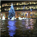
Christmas tree in Brindley Place
Christmas decorations reflected in the water feature in Brindley Place.
Image: © David P Howard Taken: 18 Dec 2012
0.02 miles
10
Christmas decorations
Christmas decorations on Brunswick Street in Birmingham.
Image: © Philip Halling Taken: 3 Dec 2016
0.02 miles
  • ...