
IMAGES TAKEN NEAR TO
Heybarnes Road, BIRMINGHAM, B10 9HT
Introduction
This page details the photographs taken nearby to Heybarnes Road, B10 9HT by members of the Geograph project.
The Geograph project started in 2005 with the aim of publishing, organising and preserving representative images for every square kilometre of Great Britain, Ireland and the Isle of Man.

There are currently over 7.5m images from over14,400 individuals and you can help contribute to the project by visiting https://www.geograph.org.uk
Image Map
Images are licensed for reuse under creativecommons.org/licenses/by-sa/2.0
Notes
- Clicking on the map will re-center to the selected point.
- The higher the marker number, the further away the image location is from the centre of the postcode.
Image Listing (11 Images Found)
Images are licensed for reuse under creativecommons.org/licenses/by-sa/2.0
Image
Details
Distance
1
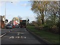
Which way for the A45?
A somewhat confusing set of road markings at the eastern end of Heath Highway. Even worse, the logical direction for the A45 is straight ahead, but it requires a distinct turn to the right. Just follow the traffic!
Image: © Peter Whatley
Taken: 7 Dec 2011
0.11 miles
2

The Coventry Road, Hay Mills, Birmingham
This photo is taken on the Hay Mills Bridge (dated 1903) looking east in the Coventry direction.
Image: © John Evans
Taken: 27 Aug 2006
0.13 miles
3
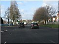
Coventry Road (A45) west of Kings Road
Image: © Peter Whatley
Taken: 7 Dec 2011
0.18 miles
4
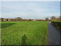
Hay Barn Rec
A large recreation ground and sports facility, bordering the River Cole on the east side, and built-up areas of Small Heath on the west.
Image: © Richard Law
Taken: 24 Nov 2014
0.20 miles
5
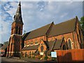
St Cyprian's Church, Hay Mills, Birmingham
St Cyprian's Church, Hay Mills is a parish church in the Church of England in Hay Mills, Birmingham. Designed by Martin & Chamberlain architects in 1873-74 and financed by James Horsfall; he was a major manufacturer and exporter of the strengthened wire to Europe and the world during the mid-19th century. A Grade II listed church.
Image: © user
Taken: 2 Oct 2011
0.20 miles
6
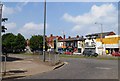
A45 Coventry Road
Viewed from the junction with Kings Road.
Image: © SMJ
Taken: 28 Jun 2009
0.21 miles
7
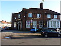
The Monica Pub, Small Heath
A little off the beaten track, The Monica lies at the junction of Somerville Road and (oddly) Monica Road.
Image: © Richard Law
Taken: 2 Jan 2015
0.22 miles
8
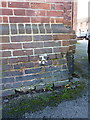
OS benchmark - Small Heath, The Monica pub
Picked out rather roughly in white paint is an OS cutmark on the NE face of The Monica; originally levelled at 110.45m above Ordnance Datum Newlyn.
Image: © Richard Law
Taken: 2 Jan 2015
0.23 miles
9
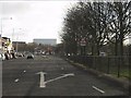
Coventry Road (A45) approaching Kings Road, eastbound
The A45 is a wide, efficient highway: surprisingly not very typical of Birmingham's arterial routes.
Image: © Peter Whatley
Taken: 7 Dec 2011
0.23 miles
10
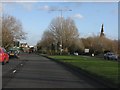
Heath Highway approaching Heybarnes Circus
Image: © Peter Whatley
Taken: 7 Dec 2011
0.24 miles