
IMAGES TAKEN NEAR TO
Woodhall Lane, WELWYN GARDEN CITY, AL7 3TB
Introduction
This page details the photographs taken nearby to Woodhall Lane, AL7 3TB by members of the Geograph project.
The Geograph project started in 2005 with the aim of publishing, organising and preserving representative images for every square kilometre of Great Britain, Ireland and the Isle of Man.

There are currently over 7.5m images from over14,400 individuals and you can help contribute to the project by visiting https://www.geograph.org.uk
Image Map
Images are licensed for reuse under creativecommons.org/licenses/by-sa/2.0
Notes
- Clicking on the map will re-center to the selected point.
- The higher the marker number, the further away the image location is from the centre of the postcode.
Image Listing (14 Images Found)
Images are licensed for reuse under creativecommons.org/licenses/by-sa/2.0
Image
Details
Distance
2
Welwyn Garden City: A1000 Chequers
Yes, it's not Chequers Road, or Chequers Lane, or Chequers anything else, just plain old Chequers.
Image: © Nigel Cox
Taken: 2 Jul 2008
0.08 miles
3
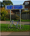
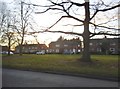
National Cycle Route direction signs, Welwyn Garden City
Image: © Jim Osley
Taken: 8 Oct 2010
0.09 miles
6
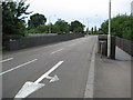
Welwyn Garden City: Twentieth Mile Bridge (original)
Twentieth Mile Bridge is so-called because it is twenty miles north of Kings Cross on the East Coast Main Line railway. It originally carried the B190 road over the railway but the road is now the A6129. A newer bridge Image has been built to the south and parallel to this one, and this one now only carries eastbound traffic. The footbridge on the right appears to have been an afterthought.
Image: © Nigel Cox
Taken: 2 Jul 2008
0.17 miles
7

Welwyn Garden City: Twentieth Mile Bridge (new)
Twentieth Mile Bridge is so-called because it is twenty miles north of Kings Cross on the East Coast Main Line railway. The original bridge Image carried the B190 road over the railway but the road is now the A6129. This is a new bridge built to alleviate traffic flow over the original bridge, and only carries westbound traffic.
Image: © Nigel Cox
Taken: 2 Jul 2008
0.17 miles
8
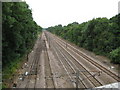
Welwyn Garden City: East Coast Main Line railway
Viewed looking from Image the points on the trackwork on the left allow London-bound suburban trains from Welwyn that have crossed the ECML on the flyover to join the up slow line.
Image: © Nigel Cox
Taken: 2 Jul 2008
0.20 miles
10
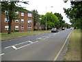
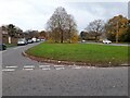
Welwyn Garden City: A1000 Broadwater Road
Viewed as the road enters the Broadwater area of Welwyn Garden City.
Image: © Nigel Cox
Taken: 2 Jul 2008
0.22 miles