IMAGES TAKEN NEAR TO
Shire Park, Kestrel Way, WELWYN GARDEN CITY, AL7 1TN
Introduction
This page details the photographs taken nearby to Shire Park, Kestrel Way, AL7 1TN by members of the Geograph project.
The Geograph project started in 2005 with the aim of publishing, organising and preserving representative images for every square kilometre of Great Britain, Ireland and the Isle of Man.

There are currently over 7.5m images from over14,400 individuals and you can help contribute to the project by visiting https://www.geograph.org.uk
Image Map
Images are licensed for reuse under creativecommons.org/licenses/by-sa/2.0
Notes
- Clicking on the map will re-center to the selected point.
- The higher the marker number, the further away the image location is from the centre of the postcode.
Image Listing (9 Images Found)
Images are licensed for reuse under creativecommons.org/licenses/by-sa/2.0
Image
Details
Distance
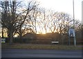
2
Woodland by Knightsfield, Welwyn Garden City
Image: © David Howard
Taken: 7 Sep 2017
0.02 miles
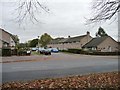
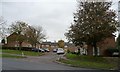
4
Haldens, Welwyn Garden city
Looking south-west, towards Bessemer Road.
Image: © Christine Johnstone
Taken: 1 Nov 2013
0.09 miles
5
Lodgefield, leading to Nursery Gardens
On the north side of Knightsfield, Welwyn Garden City.
Image: © Christine Johnstone
Taken: 1 Nov 2013
0.10 miles
6
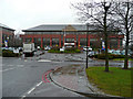
Cirrus House, Falcon Way
One of Tesco's head office buildings in Shire Park in the centre of Welwyn Garden City.
Image: © Jonathan Billinger
Taken: 10 Mar 2008
0.11 miles
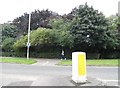
7
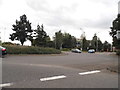
Roundabout on Bessemer Road, Welwyn Gaden City
Image: © David Howard
Taken: 7 Sep 2017
0.19 miles
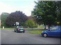
8
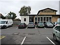
The Mayflower, Welwyn Garden City
At the junction of Sloansway and Haldens.
Image: © Christine Johnstone
Taken: 1 Nov 2013
0.23 miles
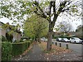
9
Houses on the north side of Knighstfield, WGC
Just west of the railway line.
Image: © Christine Johnstone
Taken: 1 Nov 2013
0.25 miles