IMAGES TAKEN NEAR TO
Westfield, WELWYN GARDEN CITY, AL7 1QS
Introduction
This page details the photographs taken nearby to Westfield, AL7 1QS by members of the Geograph project.
The Geograph project started in 2005 with the aim of publishing, organising and preserving representative images for every square kilometre of Great Britain, Ireland and the Isle of Man.

There are currently over 7.5m images from over14,400 individuals and you can help contribute to the project by visiting https://www.geograph.org.uk
Image Map
Images are licensed for reuse under creativecommons.org/licenses/by-sa/2.0
Notes
- Clicking on the map will re-center to the selected point.
- The higher the marker number, the further away the image location is from the centre of the postcode.
Image Listing (24 Images Found)
Images are licensed for reuse under creativecommons.org/licenses/by-sa/2.0
Image
Details
Distance
1
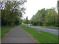
Dual use path beside Black Fan Road (B195)
Looking north west.
Image: © JThomas
Taken: 15 Apr 2017
0.06 miles
2
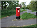
Elizabeth II postbox on Brownfields, Welwyn Garden City
Postbox No. AL7 294.
Image: © JThomas
Taken: 15 Apr 2017
0.09 miles
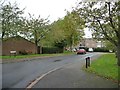
3
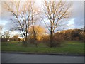
Park by Black Fan Road, Welwyn Garden City
Image: © David Howard
Taken: 25 Nov 2017
0.10 miles
4
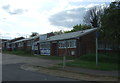
Small industrial units on Brownfields, Welwyn Garden City
Image: © JThomas
Taken: 15 Apr 2017
0.10 miles
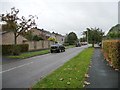
5
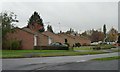
Bungalows, Daniells, Welwyn Garden City
Seen from the southern end of Windhill.
Image: © Christine Johnstone
Taken: 1 Nov 2013
0.11 miles
6
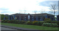
City Park Business Park, Welwyn Garden City
Image: © JThomas
Taken: 15 Apr 2017
0.12 miles
7
Houses with top-lit porches, Westly Wood
On the west side of the road.
Image: © Christine Johnstone
Taken: 1 Nov 2013
0.12 miles
8
Watchmead
Industrial estate road off Black Fan Road (B195).
Image: © JThomas
Taken: 15 Apr 2017
0.13 miles
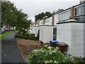
9
Corners, Welwyn Garden City
A cul-de-sac of flats, west of Windhill.
Image: © Christine Johnstone
Taken: 1 Nov 2013
0.14 miles
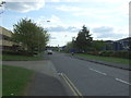
10
Westly Wood, Welwyn Garden City
Looking south from the northern junction with Daniells.
Image: © Christine Johnstone
Taken: 1 Nov 2013
0.14 miles