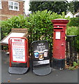
IMAGES TAKEN NEAR TO
Burgess Place, WELWYN, AL6 0FL

Introduction

This page details the photographs taken nearby to Burgess Place, AL6 0FL by members of the Geograph project.

The Geograph project started in 2005 with the aim of publishing, organising and preserving representative images for every square kilometre of Great Britain, Ireland and the Isle of Man.

There are currently over 7.5m images from over14,400 individuals and you can help contribute to the project by visiting https://www.geograph.org.uk

Image Map


Images are licensed for reuse under creativecommons.org/licenses/by-sa/2.0
Notes
  • Clicking on the map will re-center to the selected point.
  • The higher the marker number, the further away the image location is from the centre of the postcode.

Image Listing (26 Images Found)

Images are licensed for reuse under creativecommons.org/licenses/by-sa/2.0
  • ...
Image
Details
Distance
1
The Post Office at Burnham Green
Image: © Robert Edwards Taken: 6 May 2009
0.03 miles
2
Local shop, Burnham Green
Formerly a post office.
Image: © Robin Webster Taken: 5 Nov 2017
0.03 miles
3
White Horse Lane, Burnham Green, Hertfordshire
Image: © Christine Matthews Taken: 7 May 2012
0.04 miles
4
Village shop. Burnham Green
Former Post office. Showing position of Postbox No. AL6 157. See Image] for postbox.
Image: © JThomas Taken: 3 Sep 2016
0.04 miles
5
Elizabeth II postbox, Burnham Green
Outside the former Post Office. Postbox No. AL6 157. See Image] for context.
Image: © JThomas Taken: 3 Sep 2016
0.04 miles
6
Harmer Green Lane, Burnham Green
Image: © David Howard Taken: 14 Nov 2021
0.05 miles
7
Burnham Green, Hertfordshire
Looking across the green from White Horse Lane. The Trig Point can be seen just behind the deciduous tree in the centre of the image.
Image: © Christine Matthews Taken: 7 May 2012
0.05 miles
8
Burnham Green: The village sign
This appears to be a modern take on the traditional village sign featuring the village hall, a ploughman wearing what appears to be a baseball cap and, if I'm not mistaken, in the centre is Image
Image: © Nigel Cox Taken: 20 May 2015
0.06 miles
9
Burnham Green Triangulation Pillar
Placed towards the north-eastern end of the otherwise featureless village green this is an old 2nd Order pillar the co-ordinates of which have not currently been realised using the latest GPS acquired transformation parameters. Its archived OSGB36 co-ordinates are Easting 526212.875, Northing 216612.422, which are probably correct to the latest GPS datum to about 0.1 metre. Being very prominent on virtually any satellite imagery it does therefore provide a check on the accuracy of the scrolling OS co-ordinates on these images. On Where's the Path? for example I would read the co-ordinates as Easting 526212, Northing 216611, which shows their co-ordinates to be accurate to about 2 metres. The height of the flush bracket (the top of the horizontal bar above the arrow in the brass plate set in the side of the pillar) is 125.437 metres above sea level.
Image: © Nigel Cox Taken: 25 Oct 2009
0.06 miles
10
Trig point on Burnham Green's green
Image: © Patrick Mackie Taken: 3 Aug 2021
0.06 miles
  • ...