IMAGES TAKEN NEAR TO
High Street, HARPENDEN, AL5 2TB
Introduction
This page details the photographs taken nearby to High Street, AL5 2TB by members of the Geograph project.
The Geograph project started in 2005 with the aim of publishing, organising and preserving representative images for every square kilometre of Great Britain, Ireland and the Isle of Man.

There are currently over 7.5m images from over14,400 individuals and you can help contribute to the project by visiting https://www.geograph.org.uk
Image Map
Images are licensed for reuse under creativecommons.org/licenses/by-sa/2.0
Notes
- Clicking on the map will re-center to the selected point.
- The higher the marker number, the further away the image location is from the centre of the postcode.
Image Listing (463 Images Found)
Images are licensed for reuse under creativecommons.org/licenses/by-sa/2.0
Image
Details
Distance
1
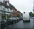
Barclays Bank & the A1081 High Street
High Street Branch
Image: © Geographer
Taken: 3 Jul 2012
0.00 miles
2
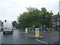
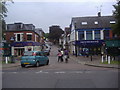
A1081 High Street, Harpenden
At the junction with Vaughan Road
Image: © Geographer
Taken: 3 Jul 2012
0.01 miles
3
Barclays Bank PLC
16, High Street, Harpenden
Image: © Geographer
Taken: 9 Jan 2013
0.01 miles
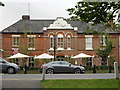
5
Vaughan Road, Harpenden
From the High Street
Image: © David Howard
Taken: 17 Aug 2011
0.01 miles
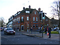
6
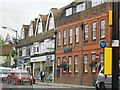
High Street Shops
From L to R: M & Co (Ladies wear), Ashtons (Estate Agents), and Barclays Bank
Image: © Gary Fellows
Taken: 8 Aug 2012
0.02 miles
7
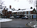
Leyton Green
At Leyton Road, leads to High Street.
Image: © Thomas Nugent
Taken: 11 Feb 2013
0.02 miles
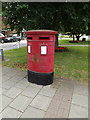
8
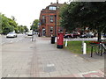
High Street Twin Postbox
On the A1081 High Street
Postbox No.AL5 117
Image: © Geographer
Taken: 12 Aug 2015
0.02 miles
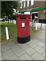
9
High Street Twin Postbox
On the A1081 High Street
Postbox No.AL5 117
Image: © Geographer
Taken: 12 Aug 2015
0.02 miles
10
High Street Twin Postbox
On the A1081 High Street
Postbox No.AL5 117
Image: © Geographer
Taken: 12 Aug 2015
0.02 miles