IMAGES TAKEN NEAR TO
The Hill, ST. ALBANS, AL4 8PR
Introduction
This page details the photographs taken nearby to The Hill, AL4 8PR by members of the Geograph project.
The Geograph project started in 2005 with the aim of publishing, organising and preserving representative images for every square kilometre of Great Britain, Ireland and the Isle of Man.

There are currently over 7.5m images from over14,400 individuals and you can help contribute to the project by visiting https://www.geograph.org.uk
Image Map
Images are licensed for reuse under creativecommons.org/licenses/by-sa/2.0
Notes
- Clicking on the map will re-center to the selected point.
- The higher the marker number, the further away the image location is from the centre of the postcode.
Image Listing (24 Images Found)
Images are licensed for reuse under creativecommons.org/licenses/by-sa/2.0
Image
Details
Distance
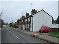
1
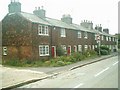
Row of Cottages on The Hill,Wheathampstead
Image: © Gary Fellows
Taken: 1 Aug 2007
0.01 miles
2
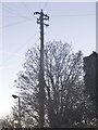
Old style telegraph pole on The Hill, Wheathampstead
Image: © David Howard
Taken: 5 Jan 2017
0.03 miles
3
Road works on The Hill, Wheathampstead
Image: © David Howard
Taken: 22 Jul 2014
0.03 miles
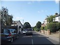
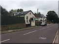
7
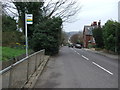
Bus stop on The Hill, Wheathampstead
Looking north on the B651.
Image: © JThomas
Taken: 18 Mar 2017
0.08 miles
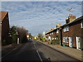
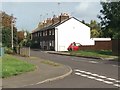
8
B651 The Hill, Wheathampstead
At the junction with Butterfield Road
Image: © Geographer
Taken: 19 Jan 2016
0.09 miles
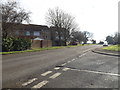
10
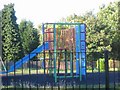
Children's Play area Vale Court Wheathampstead
Note the rubberised ground cover to prevent cuts and bruises.
Image: © Jack Hill
Taken: 28 Aug 2005
0.11 miles