IMAGES TAKEN NEAR TO
Hall Gardens, ST. ALBANS, AL4 0FS
Introduction
This page details the photographs taken nearby to Hall Gardens, AL4 0FS by members of the Geograph project.
The Geograph project started in 2005 with the aim of publishing, organising and preserving representative images for every square kilometre of Great Britain, Ireland and the Isle of Man.

There are currently over 7.5m images from over14,400 individuals and you can help contribute to the project by visiting https://www.geograph.org.uk
Image Map (Loading...)


Getting Data...Please wait
Leaflet Map data © OpenStreetMap
Images are licensed for reuse under creativecommons.org/licenses/by-sa/2.0
Notes
- Clicking on the map will re-center to the selected point.
- The higher the marker number, the further away the image location is from the centre of the postcode.
Image Listing (18 Images Found)
Images are licensed for reuse under creativecommons.org/licenses/by-sa/2.0
Image
Details
Distance
1
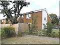
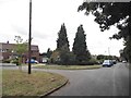
Rear of houses on Hall Gardens
From Fellowes Lane
Image: © David Howard
Taken: 23 Jul 2015
0.02 miles
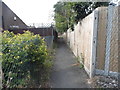
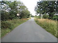
4
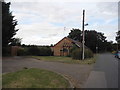
Fellowes Lane, Roestock
The furniture was for the public to take away
Image: © David Howard
Taken: 23 Jul 2015
0.06 miles
5
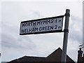
Fingerpost on Fellowes Lane, Roestock
This is double sided, and a modern copy of original pre-Worboys signs made on the same format. They were very rare but caught the pair in Stanmore before they were removed. http://www.geograph.org.uk/photo/3514766
Image: © David Howard
Taken: 23 Jul 2015
0.07 miles
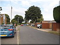
10
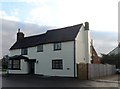
The former Queen's Head pub, Colney Heath
It had ceased to be a pub by 2013. See http://www.geograph.org.uk/photo/25047 and http://www.geograph.org.uk/photo/117885 for when it still was. Strangely, the pub's presence lingers on in the form of a website http://thequeensheadcolneyheath.co.uk/
The building dates from the C17 and the bay at the front is reported to have been used for the collection of coal tax although this is very unlikely. See http://www.britishlistedbuildings.co.uk/en-163556-queens-head-public-house-colney-heath-he for entry in British Listed Buildings.
Image: © Bikeboy
Taken: 31 Dec 2014
0.18 miles