IMAGES TAKEN NEAR TO
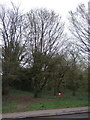
Gorse Corner, Townsend Drive, ST. ALBANS, AL3 5SH
Introduction
This page details the photographs taken nearby to Gorse Corner, Townsend Drive, AL3 5SH by members of the Geograph project.
The Geograph project started in 2005 with the aim of publishing, organising and preserving representative images for every square kilometre of Great Britain, Ireland and the Isle of Man.

There are currently over 7.5m images from over14,400 individuals and you can help contribute to the project by visiting https://www.geograph.org.uk
Image Map
Images are licensed for reuse under creativecommons.org/licenses/by-sa/2.0
Notes
- Clicking on the map will re-center to the selected point.
- The higher the marker number, the further away the image location is from the centre of the postcode.
Image Listing (32 Images Found)
Images are licensed for reuse under creativecommons.org/licenses/by-sa/2.0
Image
Details
Distance
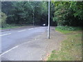
1
Townsend Drive
Developed in the 1930s or so, although the road is shown on late 19th century maps (as Townsend Road). On the left is part of Bernard's Heath.
Image: © Ian Capper
Taken: 22 Sep 2011
0.06 miles
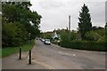
2
Townsend Drive
Road bordering Bernard's Heath (on the left), first marked on the 1898 1:2,500 map as Townsend Road, but with no development. The 1924 edition was similar, but the 1939 edition showed housing as here, and with the current name.
Image: © Ian Capper
Taken: 24 Jul 2020
0.07 miles
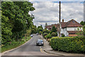
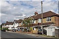
3
Harpenden Road (A1081)
Heading north west from St Albans.
Image: © JThomas
Taken: 18 Mar 2017
0.10 miles
4
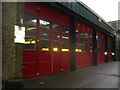
Doors to the fire station at Bernards Heath St Albans
This fire station is about to be closed for the new one almost complete in London Road.
Image: © Jack Hill
Taken: 19 Aug 2005
0.11 miles
5
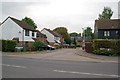
Edmond Beaufort Drive
A small close off Harpenden Road, on the edge of Bernards Heath. It was named after Edmund (or Edmond) Beaufort, Duke of Somerset, who was killed in the First Battle of St Albans in 1455.
Image: © Ian Capper
Taken: 22 Sep 2011
0.11 miles
6
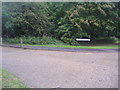
Heathlands Drive, St Albans
The entrance to the fire and ambulance stations
Image: © David Howard
Taken: 17 Aug 2011
0.11 miles
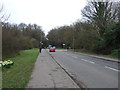
7
Palfrey Close
c1930s housing built on what was previously allotments.
Image: © Ian Capper
Taken: 24 Jul 2020
0.11 miles
9
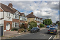
Waverley Road
c1930s housing on a road which old maps show when built followed the original municipal boundary of the city of St Albans.
Image: © Ian Capper
Taken: 24 Jul 2020
0.12 miles