IMAGES TAKEN NEAR TO
Frogmore Home Park, ST. ALBANS, AL2 2LN
Introduction
This page details the photographs taken nearby to Frogmore Home Park, AL2 2LN by members of the Geograph project.
The Geograph project started in 2005 with the aim of publishing, organising and preserving representative images for every square kilometre of Great Britain, Ireland and the Isle of Man.

There are currently over 7.5m images from over14,400 individuals and you can help contribute to the project by visiting https://www.geograph.org.uk
Image Map
Images are licensed for reuse under creativecommons.org/licenses/by-sa/2.0
Notes
- Clicking on the map will re-center to the selected point.
- The higher the marker number, the further away the image location is from the centre of the postcode.
Image Listing (65 Images Found)
Images are licensed for reuse under creativecommons.org/licenses/by-sa/2.0
Image
Details
Distance
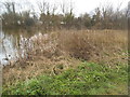
1
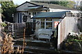
Garden by the River Ver
An interesting collection.
Image: © Robert Eva
Taken: 3 Nov 2016
0.04 miles
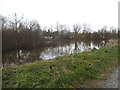
2
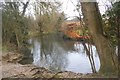
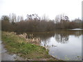
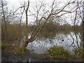
The River Ver at Frogmore Lakes
The river giving St Albans its Roman name, Verulamium, city on the Ver.
Image: © David Howard
Taken: 29 Mar 2016
0.06 miles
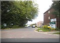
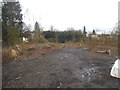
4
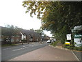
Park Street at the entrance to Curo Park industrial estate
Image: © David Howard
Taken: 2 Sep 2014
0.09 miles
9
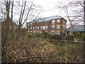
Flats on Minister Court across the River Ver
Image: © David Howard
Taken: 29 Mar 2016
0.10 miles