
IMAGES TAKEN NEAR TO
Burr Close, ST. ALBANS, AL2 1RD
Introduction
This page details the photographs taken nearby to Burr Close, AL2 1RD by members of the Geograph project.
The Geograph project started in 2005 with the aim of publishing, organising and preserving representative images for every square kilometre of Great Britain, Ireland and the Isle of Man.

There are currently over 7.5m images from over14,400 individuals and you can help contribute to the project by visiting https://www.geograph.org.uk
Image Map
Images are licensed for reuse under creativecommons.org/licenses/by-sa/2.0
Notes
- Clicking on the map will re-center to the selected point.
- The higher the marker number, the further away the image location is from the centre of the postcode.
Image Listing (154 Images Found)
Images are licensed for reuse under creativecommons.org/licenses/by-sa/2.0
Image
Details
Distance
1
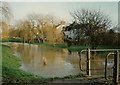
River Colne in spate at London Colney
In the wet winter of 1993, which followed nearly three years of drought when the river almost dried up. There is another more current image on this website taken very close to this which shows the usual size and flow of the river and also refers to flooding during 2001/02.
Image: © David Leeming
Taken: Unknown
0.02 miles
2
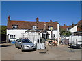
The Green Dragon - Refurbishment August 2016
The pub was closed for much of August for a major refurbishment - here work is seen in progress. See Image for a view of the completed works.
Image: © John Webb
Taken: 12 Aug 2016
0.02 miles
3
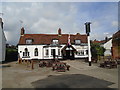
The Green Dragon after refurbishment, August 2016
The exterior of the Green Dragon in late August after reopening after some weeks of refurbishment. There is a new sign post - the last one was knocked over by a car earlier this year only a week or two after a new signboard had been put on it! (Compare with Image taken in 2009 - no major changes have occurred, but the exterior, and interior, have been smartened up a bit without losing too much character.) See Image for an interesting feature of the refurbished interior.
Image: © John Webb
Taken: 29 Aug 2016
0.02 miles
4
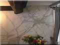
Green Dragon pub - interior after refurbishment 2016
The end wall of the main bar inside the pub has been decorated by an extract from the OS 1866 survey (published 1868) 6inch:1 mile map of London Colney, which makes an interesting talking point when eating and drinking there.
Image: © John Webb
Taken: 9 Sep 2016
0.02 miles
5
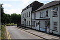
Waterside running down towards the river
Image: © Philip Jeffrey
Taken: 10 Jul 2013
0.04 miles
6
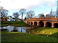
River Colne and Telford'sBridge, London Colney
Built in 1774. See http://www.britishlistedbuildings.co.uk/en-163648-telfords-bridge-london-colney-hertfordsh for entry in British Listed Buildings.
Image: © Bikeboy
Taken: 19 Jan 2014
0.04 miles
7
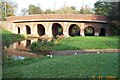
London Colney: Bridge over the River Colne
The fine seven arch bridge carrying the main road through London Colney over the River Colne, viewed looking upstream and eastwards. London Colney used to be the last stop on a coaching route from the north into London, and there are two pubs, The Bull and the Green Dragon, on either side of the river. In front of the bridge is a ford.
Image: © Nigel Cox
Taken: 5 Nov 2005
0.04 miles
8
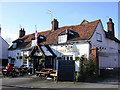
Green Dragon pub
Traditional pub dating back to 1758 in a pleasant spot overlooking the River Colne
Image: © Mark Percy
Taken: 8 Feb 2009
0.04 miles
9
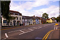
Village Street, London Colney
Looking north towards the colourful houses in this village street.
Image: © Christine Matthews
Taken: 21 Aug 2009
0.05 miles
10
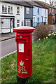
Post box
EIIR post box with gold painted cypher, sited on the High Street below Telford's Bridge.
Image: © Ian Capper
Taken: 15 Mar 2022
0.05 miles