IMAGES TAKEN NEAR TO
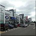
Colney Fields Shopping Park, ST. ALBANS, AL2 1AB

Introduction

This page details the photographs taken nearby to Colney Fields Shopping Park, AL2 1AB by members of the Geograph project.

The Geograph project started in 2005 with the aim of publishing, organising and preserving representative images for every square kilometre of Great Britain, Ireland and the Isle of Man.

There are currently over 7.5m images from over14,400 individuals and you can help contribute to the project by visiting https://www.geograph.org.uk

Image Map


Images are licensed for reuse under creativecommons.org/licenses/by-sa/2.0
Notes
  • Clicking on the map will re-center to the selected point.
  • The higher the marker number, the further away the image location is from the centre of the postcode.

Image Listing (18 Images Found)

Images are licensed for reuse under creativecommons.org/licenses/by-sa/2.0
Image
Details
Distance
1
Colney Fields Shopping Park, London Colney
Image: © Bryn Holmes Taken: 25 May 2015
0.02 miles
2
Traffic waits on exit slip road at Junction 22
Image: © Colin Pyle Taken: 9 May 2011
0.08 miles
3
Pylon by the M25
Image: © N Chadwick Taken: 14 Dec 2013
0.08 miles
4
London Orbital Motorway (M25) at Junction 22 (Bell Roundabout)
The Bell Roundabout is junction 22 of the M25. It used to be a roundabout on the A6 at the southern end of the London Colney bypass, with the old route and the B556. When the final bit of the M25, between the A41 and A1(M) was built, the A6 dual carriageway south of here was upgraded to a motorway and the junction turned into a modified dumbbell (with an extra two roundabouts on the south side of the motorway) keeping the original roundabout (https://www.sabre-roads.org.uk/wiki/index.php?title=The_Bell_Roundabout SABRE).
Image: © David Dixon Taken: 11 Aug 2023
0.09 miles
5
M25 clockwise
Image: © Alex McGregor Taken: 7 Apr 2011
0.11 miles
6
A1081 London Colney Bypass exit
Off The Bell Roundabout
Image: © Geographer Taken: 3 Jul 2012
0.14 miles
7
London Colney: Sainsbury's, Colney Fields Retail Park
This Sainsbury's, just off Junction 22 of the M25 Motorway, is a little out of the ordinary as it used to be one of the company's Savacentre sites, of which there were only 13 in the country. The Savacentre brand was formed in 1975, originally as a joint enterprise between Sainsbury's and Bhs, selling food, clothing and electrical items, but became a wholly owned subsidiary of Sainsbury's in 1989. At the time they were built these 13 sites were some of the largest retail outlets in the country, but nowadays are indistinguishable from any new out-of-town supermarket, and the Savacentre brand name appears to have disappeared.
Image: © Nigel Cox Taken: 22 May 2009
0.15 miles
8
Entrance to M25 on roundabout, near London Colney
Image: © David Howard Taken: 11 Mar 2011
0.15 miles
9
M25 clockwise
Nearing junction 22.
Image: © Robin Webster Taken: 17 Feb 2018
0.16 miles
10
London Colney: Thamesdale and Willowside bus stops
The Thamesdale bus stops are the near ones - the Willowside ones can be seen on either side of the black car in the distance. These are regular stops on Barnet Road which all buses have to observe. The ones on the left side of the road are only about 130 metres apart and it took your decrepit photographer 1 minute and 25 seconds to walk between them. Are these the closest together regular bus stops in the country???!!!
Image: © Nigel Cox Taken: 31 Jul 2015
0.16 miles