IMAGES TAKEN NEAR TO
Ryder Seed Mews, Pageant Road, ST. ALBANS, AL1 1NL

Introduction

This page details the photographs taken nearby to Ryder Seed Mews, Pageant Road, AL1 1NL by members of the Geograph project.

The Geograph project started in 2005 with the aim of publishing, organising and preserving representative images for every square kilometre of Great Britain, Ireland and the Isle of Man.

There are currently over 7.5m images from over14,400 individuals and you can help contribute to the project by visiting https://www.geograph.org.uk

Image Map


Images are licensed for reuse under creativecommons.org/licenses/by-sa/2.0
Notes
  • Clicking on the map will re-center to the selected point.
  • The higher the marker number, the further away the image location is from the centre of the postcode.

Image Listing (770 Images Found)

Images are licensed for reuse under creativecommons.org/licenses/by-sa/2.0
  • ...
Image
Details
Distance
1
Albert Street
Originally a lane giving access to the rear of the inns of Holywell Hill and The Goat in Sopwell Lane (see Image), it was developed as a residential street in the mid 19th century. These houses are locally listed. On the wall of the first building on the left can be seen a World War 1 Street Memorial (see Image for close up).
Image: © Ian Capper Taken: 3 May 2012
0.01 miles
2
World War 1 Street Memorial, Albert Street
See description below. This one is in Albert Street, commemorating residents of that road. This was the first of the 10 street memorials to be dedicated, in Spring 1920. For wider view see Image
Image: © Ian Capper Taken: 3 May 2012
0.02 miles
3
Albert Street
Originally a lane giving access to the rear of the inns of Holywell Hill and The Goat in Sopwell Lane (see Image), it was developed as a residential street in the mid 19th century. These houses are locally listed.
Image: © Ian Capper Taken: 4 Dec 2011
0.02 miles
4
Western end of Pageant Road
Image: © Basher Eyre Taken: 29 Aug 2021
0.03 miles
5
May Cottage, Sopwell Lane, St Albans
Image: © Brian Smith Taken: 17 Oct 2007
0.03 miles
6
Caf? Rouge, St Albans
It looks very blanc on the outside.
Image: © Robin Webster Taken: 14 May 2017
0.03 miles
7
Former chapel, Sopwell Lane
A former chapel in Sopwell Lane dating from the late 18th/early 19th century. It was originally a Primitive Methodist Church and subsequently used by the Baptists as a Mission Room for Dagnall Street Baptist Church (see Image), and was marked as a Mission Hall on large scale maps from 1880 to 1924. It was subsequently used from 1934 to 2003 by the St Albans City Band as its rehearsal rooms. It has recently been restored as a house, named The Old Band Hall, in recognition of its former use. Locally listed.
Image: © Ian Capper Taken: 4 Dec 2011
0.04 miles
8
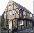
26 Sopwell Lane
A grade II listed cottage dating from the 16th century. For listing particulars see www.historicengland.org.uk/listing/the-list/list-entry/1103058.
Image: © Ian Capper Taken: 4 Dec 2011
0.04 miles
9
St Albans, Cafe Rouge, Holywell Hill
Image: © Roy Hughes Taken: 21 Apr 2012
0.04 miles
10
Caf? Rouge, St Albans
Image: © David Smith Taken: 29 Jun 2012
0.04 miles
  • ...