
IMAGES TAKEN NEAR TO
Provost Reid Crescent, BUCKIE, AB56 1BH
Introduction
This page details the photographs taken nearby to Provost Reid Crescent, AB56 1BH by members of the Geograph project.
The Geograph project started in 2005 with the aim of publishing, organising and preserving representative images for every square kilometre of Great Britain, Ireland and the Isle of Man.

There are currently over 7.5m images from over14,400 individuals and you can help contribute to the project by visiting https://www.geograph.org.uk
Image Map
Images are licensed for reuse under creativecommons.org/licenses/by-sa/2.0
Notes
- Clicking on the map will re-center to the selected point.
- The higher the marker number, the further away the image location is from the centre of the postcode.
Image Listing (34 Images Found)
Images are licensed for reuse under creativecommons.org/licenses/by-sa/2.0
Image
Details
Distance
1
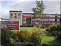
Buckie High School
Buckie High School as seen from Queen Street. The mural celebrates the school's link with Tanzania.
Image: © Chris S
Taken: 6 Sep 2002
0.17 miles
2
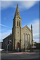
South and West Kirk
This kirk was originally a Free Kirk, built in 1849-1850 to a design by Alexander and William Reid of Elgin. It was altered in 1885. With the reunion of part of the Free Church with the Church of Scotland in 1929, it became Buckie South, and when the West Kirk closed in 1970 this was renamed Buckie South and West. See http://scottishchurches.org.uk/sites/site/id/7931/name/South+and+West+Church%2C+Buckie+Buckie+Grampian for more details.
Image: © Anne Burgess
Taken: 13 Oct 2017
0.17 miles
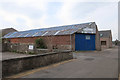
6
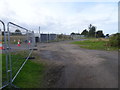
Buckie HR railway station (site), Moray
Opened in 1844 by the Highland Railway on the branch from Keith Junction to Portessie, this station closed to passengers in 1915 and completely in 1944.
View north towards Portessie from approximately the track-bed. The single track and platform to the left of it, curved round to the right. The site is now in the middle of a housing estate but as it was started when the track was still there, its route can still be made out on a map.
Image: © Nigel Thompson
Taken: 5 Sep 2019
0.21 miles
7
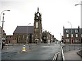
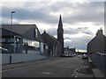
East Church Street Buckie
My Grandfather owned a Grocers shop 90 years ago on the left hand side of the street in the middle distance! My Father was lived in the house above the shop!!
Image: © Christopher Gillan
Taken: 22 Jan 2006
0.21 miles
8
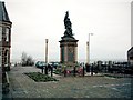
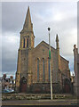
War Memorial Buckie
The War Memorial is situated in Cluny Square Buckie
Image: © Christopher Gillan
Taken: 22 Jan 2006
0.22 miles
9
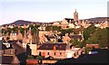
Buckie
Warm evening sunshine picks out the colours of the town of Buckie
Image: © Anne Burgess
Taken: 8 Jun 1988
0.22 miles
10
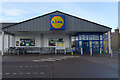
Lidl Supermarket
The car park isn't completely empty, but for once there are no cars in front of the main door.
Image: © Anne Burgess
Taken: 26 Jan 2021
0.22 miles