South and West Kirk
Introduction
The photograph on this page of South and West Kirk by Anne Burgess as part of the Geograph project.
The Geograph project started in 2005 with the aim of publishing, organising and preserving representative images for every square kilometre of Great Britain, Ireland and the Isle of Man.

There are currently over 7.5m images from over 14,400 individuals and you can help contribute to the project by visiting https://www.geograph.org.uk
South and West Kirk
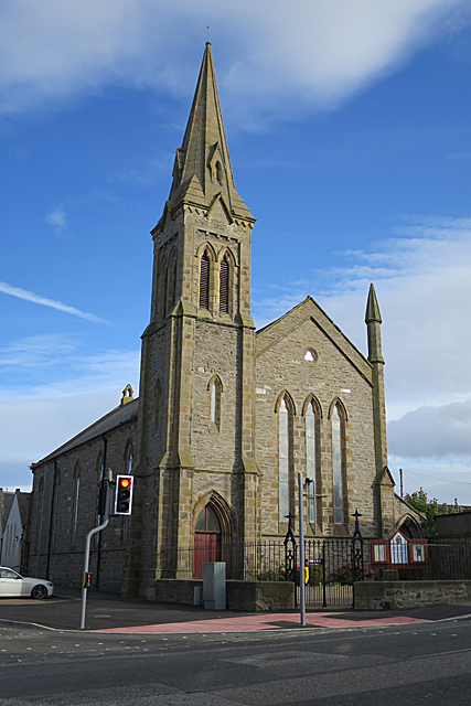
Image: © Anne Burgess Taken: 13 Oct 2017
This kirk was originally a Free Kirk, built in 1849-1850 to a design by Alexander and William Reid of Elgin. It was altered in 1885. With the reunion of part of the Free Church with the Church of Scotland in 1929, it became Buckie South, and when the West Kirk closed in 1970 this was renamed Buckie South and West. See http://scottishchurches.org.uk/sites/site/id/7931/name/South+and+West+Church%2C+Buckie+Buckie+Grampian for more details.
Images are licensed for reuse under creativecommons.org/licenses/by-sa/2.0
Image Location
Latitude
57.675059
Longitude
-2.963532