IMAGES TAKEN NEAR TO
Jake Forbes Close, HUNTLY, AB54 8HS

Introduction

This page details the photographs taken nearby to Jake Forbes Close, AB54 8HS by members of the Geograph project.

The Geograph project started in 2005 with the aim of publishing, organising and preserving representative images for every square kilometre of Great Britain, Ireland and the Isle of Man.

There are currently over 7.5m images from over14,400 individuals and you can help contribute to the project by visiting https://www.geograph.org.uk

Image Map


Images are licensed for reuse under creativecommons.org/licenses/by-sa/2.0
Notes
  • Clicking on the map will re-center to the selected point.
  • The higher the marker number, the further away the image location is from the centre of the postcode.

Image Listing (59 Images Found)

Images are licensed for reuse under creativecommons.org/licenses/by-sa/2.0
  • ...
Image
Details
Distance
1
Jake Forbes Close
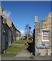
Apart from the satellite dishes, street lamps and garish blue street signs, this could be a glimpse into the 18th century in the oldest part of Huntly, on the west bank of the River Bogie. Jake Forbes was a traditional musician who became a popular local celebrity.
Image: © Anne Burgess Taken: 10 Mar 2015
0.01 miles
2
Jake Forbes Close, Huntly
To the left, barely visible, a group of houses built around 1800, Listed Category C. On the right is 58 Bogie Street, dated 1793 although the looks are older and the Canmore entry indicates that title deeds date back to 1745/6. Listed Category B.
Image: © Alan Murray-Rust Taken: 20 May 2022
0.01 miles
3
Old Huntly
Some of Huntly's oldest residential buildings on Bogie Street beside the river. Note that the gable-ends face the road.
Image: © Bill Harrison Taken: 29 May 2016
0.01 miles
4
Jake Forbes Close
The gable ends of the houses on either side of Jake Forbes Close where it joins Bogie Street.
Image: © Anne Burgess Taken: 10 Mar 2015
0.02 miles
5
Houses above the River Bogie
These houses in Lennox Terrace face east, away from the street and towards the river, which is just out of sight at lower right.
Image: © Anne Burgess Taken: 11 Feb 2015
0.03 miles
6
A cottage at the east end of Bogie Street
By the Bogie Bridge.
Image: © Stanley Howe Taken: 13 Aug 2012
0.04 miles
7
Old Warehouses
The lifting beam above the roof-level door in the highest part of the building suggests that these buildings were originally a warehouse of some kind, but the buildings are not listed so I have not discovered their history.
Image: © Anne Burgess Taken: 19 Jul 2021
0.04 miles
8
River Bogie, Huntly
The Bogie flows roughly north for about 9 km to Milltown of Rothiemay, where it changes name to the River Deveron, which eventually meets the sea between Banff and Macduff.
Image: © Bill Harrison Taken: 29 May 2016
0.05 miles
9
River Bogie at Huntly
Downstream of Bogie Bridge.
Image: © Richard Slessor Taken: 20 Jun 2005
0.05 miles
10
Upstream parapet of Bogie Bridge
Huntly.
Image: © Stanley Howe Taken: 13 Aug 2012
0.05 miles
  • ...