
IMAGES TAKEN NEAR TO
Walker Court, Cornhill Road, HUNTLY, AB54 7SD
Introduction
This page details the photographs taken nearby to Walker Court, Cornhill Road, AB54 7SD by members of the Geograph project.
The Geograph project started in 2005 with the aim of publishing, organising and preserving representative images for every square kilometre of Great Britain, Ireland and the Isle of Man.

There are currently over 7.5m images from over14,400 individuals and you can help contribute to the project by visiting https://www.geograph.org.uk
Image Map
Images are licensed for reuse under creativecommons.org/licenses/by-sa/2.0
Notes
- Clicking on the map will re-center to the selected point.
- The higher the marker number, the further away the image location is from the centre of the postcode.
Image Listing (56 Images Found)
Images are licensed for reuse under creativecommons.org/licenses/by-sa/2.0
Image
Details
Distance
1
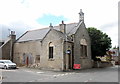
Former United Presbyterian Church, Cornhill Road, Aberchirder
Dating from ca. 1890, it became redundant as soon as 1900 when the UPs and the Frees merged. It was later a petrol station and then fell into dereliction, but it now (July 2017) being renovated, presumably as housing.
Image: © Bill Harrison
Taken: 1 Jul 2017
0.05 miles
2
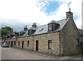
Terraced cottages, North Street, Aberchirder
Image: © Bill Harrison
Taken: 1 Jul 2017
0.05 miles
3

Hamewith
This interesting house was originally a manse, no doubt associated with the United Presbyterian kirk almost next door.
Image: © Anne Burgess
Taken: 12 May 2025
0.05 miles
4

West End of North Street
A terrace of solid traditional stone houses.
Image: © Anne Burgess
Taken: 12 May 2025
0.06 miles
5
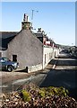
North Street
Aberchirder is typical of an 18th century planned village, with straight streets and the houses parallel to the street, their doors opening straight on to the pavement.
Image: © Anne Burgess
Taken: 27 Feb 2008
0.07 miles
6

West Hall
This was a United Presbyterian and later a United Free kirk, designed by Duncan Macmillan and built in 1893, replacing an earlier kirk on the same site. It is Category C Listed. See https://portal.historicenvironment.scot/apex/f?p=1505:300:::::VIEWTYPE,VIEWREF:designation,LB19920 for details.
Later it was a cinema and a petrol filling station. It is now being restored and converted for use as holiday accommodation. See https://www.aberdeenlive.news/news/aberdeen-news/historic-aberdeenshire-church-could-become-8148050
Comparing this image with Image] you can see that at some point a large square door was inserted in the blank wall, and that this in turn has been replaced by two tall round-arched windows and three oculi to restore it to its original appearance. You can just about make out the traces of the original arches and oculi in the older image.
Image: © Anne Burgess
Taken: 12 May 2025
0.07 miles
7
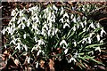
Snowdrops (Galanthus nivalis)
A large clump of snowdrops by the path through the woodland.
Image: © Anne Burgess
Taken: 27 Feb 2008
0.08 miles
8
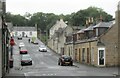
Aberchirder - Rainy Foggie
"When Alexander Gordon, the laird of Auchintoul, decided in 1764 to found a planned village he selected a spot at the south end of Auchintoul Moss. Here there was a fermtoun called Foggieloan (from two Gaelic words foidh (peat moss) and lòn (meadow), so Foggieloan means peaty or boggy meadow), so he gave his village the same name".
www.foggieloan.co.uk
Image: © Colin Smith
Taken: 6 Jul 2024
0.10 miles
9

Main Street
The west end of Main Street from the slope up to Clean Hill.
Image: © Anne Burgess
Taken: 12 May 2025
0.10 miles
10

The Aul' Jile
This Category C Listed house, now renamed Woodside Cottage, was built in the mid-19th century as the town's police station and jail. The Listed Building citation https://portal.historicenvironment.scot/apex/f?p=1505:300:::::VIEWTYPE,VIEWREF:designation,LB19917 says that it has a "regrettable modern door and shutters". The shutters seem to have been removed, so perhaps the owner has also replaced the "regrettable door" with something more appropriate.
Image: © Anne Burgess
Taken: 12 May 2025
0.11 miles