IMAGES TAKEN NEAR TO
Ythanwells, HUNTLY, AB54 6EX
Introduction
This page details the photographs taken nearby to AB54 6EX by members of the Geograph project.
The Geograph project started in 2005 with the aim of publishing, organising and preserving representative images for every square kilometre of Great Britain, Ireland and the Isle of Man.

There are currently over 7.5m images from over14,400 individuals and you can help contribute to the project by visiting https://www.geograph.org.uk
Image Map
Images are licensed for reuse under creativecommons.org/licenses/by-sa/2.0
Notes
- Clicking on the map will re-center to the selected point.
- The higher the marker number, the further away the image location is from the centre of the postcode.
Image Listing (4 Images Found)
Images are licensed for reuse under creativecommons.org/licenses/by-sa/2.0
Image
Details
Distance
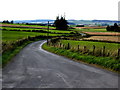
1
Fence-lined track to Backhills
Looking north-eastward.
Image: © Peter Wood
Taken: 26 Oct 2018
0.04 miles
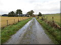
2
Rolls of Wire
It's fine to see old barbed wire carefully rolled up and tidily stacked, rather than dumped in a tangle or, even worse, left lying in the grass where it could injure wildlife or walkers. I have scars as evidence of the latter practice.
Image: © Anne Burgess
Taken: 10 Mar 2015
0.09 miles
3
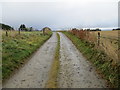
Fence-lined track to Hillside and Dalebrook
Looking south-westward.
Image: © Peter Wood
Taken: 26 Oct 2018
0.13 miles