IMAGES TAKEN NEAR TO
Gartly, HUNTLY, AB54 6AD
Introduction
This page details the photographs taken nearby to AB54 6AD by members of the Geograph project.
The Geograph project started in 2005 with the aim of publishing, organising and preserving representative images for every square kilometre of Great Britain, Ireland and the Isle of Man.

There are currently over 7.5m images from over14,400 individuals and you can help contribute to the project by visiting https://www.geograph.org.uk
Image Map
Images are licensed for reuse under creativecommons.org/licenses/by-sa/2.0
Notes
- Clicking on the map will re-center to the selected point.
- The higher the marker number, the further away the image location is from the centre of the postcode.
Image Listing (12 Images Found)
Images are licensed for reuse under creativecommons.org/licenses/by-sa/2.0
Image
Details
Distance
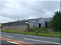
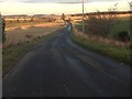
3
Roadside cottage
Cottage near Leys of Dummuies.
Image: © James Allan
Taken: 1 Dec 2006
0.13 miles
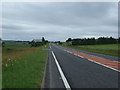
5
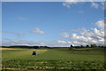
Forage Cut
Grass being cut for silage by the A96.
Image: © Andrew Wood
Taken: 17 Aug 2011
0.14 miles
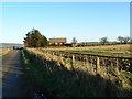
7
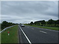
Grazing and track
Off the A96 near Leys of Dummuies.
Image: © JThomas
Taken: 20 Jul 2014
0.19 miles
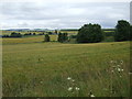
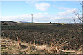
8
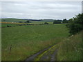
Grass by Slioch
Grassland by the A96 with the farm and hill of Slioch behind.
Image: © Andrew Wood
Taken: 17 Aug 2011
0.19 miles
10
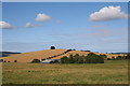
Ploughed Field near Leys of Dummuies
This is from the minor road off the A96, which runs along the far side of this field.
Image: © Anne Burgess
Taken: 4 Mar 2015
0.21 miles