IMAGES TAKEN NEAR TO
Lumsden, HUNTLY, AB54 4JU
Introduction
This page details the photographs taken nearby to AB54 4JU by members of the Geograph project.
The Geograph project started in 2005 with the aim of publishing, organising and preserving representative images for every square kilometre of Great Britain, Ireland and the Isle of Man.

There are currently over 7.5m images from over14,400 individuals and you can help contribute to the project by visiting https://www.geograph.org.uk
Image Map
Images are licensed for reuse under creativecommons.org/licenses/by-sa/2.0
Notes
- Clicking on the map will re-center to the selected point.
- The higher the marker number, the further away the image location is from the centre of the postcode.
Image Listing (10 Images Found)
Images are licensed for reuse under creativecommons.org/licenses/by-sa/2.0
Image
Details
Distance
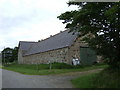
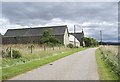
1
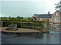
Battlehillock
An outstanding looking farm conversion.
Image: © Andrew Stuart
Taken: 20 May 2007
0.02 miles
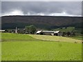
2
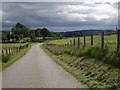
Approach to Battlehillock
From Birkenbower Mill.
Image: © Stanley Howe
Taken: 25 Aug 2010
0.03 miles
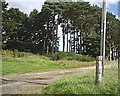
3
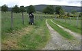
Track to Muirs of Clova
The strange letter-box looks worthy of closer inspection.
Image: © Stanley Howe
Taken: 15 Jun 2007
0.13 miles
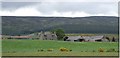
5
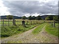
Access to Lewishillock
From near Backstone.
Image: © Stanley Howe
Taken: 25 Aug 2010
0.16 miles
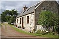
6
Approach to Backstone steading
From the north.
Image: © Stanley Howe
Taken: 25 Aug 2010
0.22 miles