IMAGES TAKEN NEAR TO
Lumsden, HUNTLY, AB54 4JT
Introduction
This page details the photographs taken nearby to AB54 4JT by members of the Geograph project.
The Geograph project started in 2005 with the aim of publishing, organising and preserving representative images for every square kilometre of Great Britain, Ireland and the Isle of Man.

There are currently over 7.5m images from over14,400 individuals and you can help contribute to the project by visiting https://www.geograph.org.uk
Image Map
Images are licensed for reuse under creativecommons.org/licenses/by-sa/2.0
Notes
- Clicking on the map will re-center to the selected point.
- The higher the marker number, the further away the image location is from the centre of the postcode.
Image Listing (20 Images Found)
Images are licensed for reuse under creativecommons.org/licenses/by-sa/2.0
Image
Details
Distance
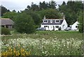
2
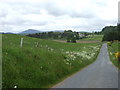
A Storm at The Whitehouse ?
One of the cottages just to the west of Lumsden taken from Hunnybarrel to Lumsden road on a stormy afternoon.
Image: © Andrew Stuart
Taken: 20 May 2007
0.02 miles
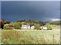
3
View towards Chapelton (Lumsden)
From the Birkenbower road.
Image: © Stanley Howe
Taken: 15 Jun 2007
0.06 miles
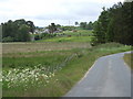
7
Junction of Birkenbower road with A97 in Lumsden
Title tidied up.
Image: © Stanley Howe
Taken: 15 Jun 2007
0.16 miles
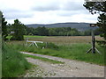
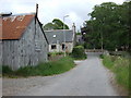
8
A house in Lumsden
Opposite junction with Birkenbower road.
Image: © Stanley Howe
Taken: 15 Jun 2007
0.16 miles
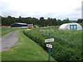
9
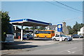
Lumsden petrol station
The brand of petrol sold has changed to Gulf from the obscure Thames since Stanley Howe took his picture eight years ago: http://www.geograph.org.uk/photo/1575874 . The village shop is also now closed (http://www.geograph.org.uk/photo/13955 ) and the garage shop serves as the village post office for a few hours per week.
Image: © Bill Harrison
Taken: 23 Sep 2017
0.19 miles
10
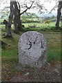
Old Milestone by the A97, Lumsden, Auchindoir and Kearn parish
Milestone by the A97, in parish of Auchindoir and Kearn (District), Lumsden, North of school, near Sculpture Walk, West side of road.
Inscription reads:-
34
(To Aberdeen)
Surveyed
Milestone Society National ID: AD_ALHN34
Image: © Milestone Society
Taken: Unknown
0.19 miles