IMAGES TAKEN NEAR TO
Lumsden, HUNTLY, AB54 4JL

Introduction

This page details the photographs taken nearby to AB54 4JL by members of the Geograph project.

The Geograph project started in 2005 with the aim of publishing, organising and preserving representative images for every square kilometre of Great Britain, Ireland and the Isle of Man.

There are currently over 7.5m images from over14,400 individuals and you can help contribute to the project by visiting https://www.geograph.org.uk

Image Map


Images are licensed for reuse under creativecommons.org/licenses/by-sa/2.0
Notes
  • Clicking on the map will re-center to the selected point.
  • The higher the marker number, the further away the image location is from the centre of the postcode.

Image Listing (27 Images Found)

Images are licensed for reuse under creativecommons.org/licenses/by-sa/2.0
  • ...
Image
Details
Distance
1
Sinuous wall around Lumsden mausoleum
Image: © Stanley Howe Taken: 14 Jul 2008
0.07 miles
2
View west from Lumsden mausoleum
Image: © Stanley Howe Taken: 14 Jul 2008
0.07 miles
3
Lumsden family mausoleum
Image: © Stanley Howe Taken: 14 Jul 2008
0.07 miles
4
Gated access to Lumsden mausoleum
Image: © Stanley Howe Taken: 14 Jul 2008
0.08 miles
5
Bend in the bog stripe
Just downstream of the A97 bridge over it, in Lumsden.
Image: © Stanley Howe Taken: 17 Feb 2011
0.15 miles
6
Bridge over a Bog Stripe
Carrying A97 into Lumsden (left).
Image: © Stanley Howe Taken: 17 Feb 2011
0.16 miles
7
Road junction for Clova
From A97, at north end of Lumsden.
Image: © Stanley Howe Taken: 10 Nov 2009
0.16 miles
8
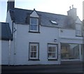
Lumsden Sculpture Workshop
At least it was! The letters announcing it as such seem to have gone from over the shop window since I last passed by. Can anyone please advise if it has a new raison d'etre?
Image: © Stanley Howe Taken: 17 Feb 2011
0.17 miles
9
An Old Tractor
Possibly a Ferguson or a Fordson.
Image: © Andrew Stuart Taken: 20 May 2007
0.17 miles
10
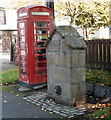
Lumsden well
Dating from 1814 and the only listed structure in the village (LB2739): http://portal.historicenvironment.scot/designation/LB2739 .
Image: © Bill Harrison Taken: 23 Sep 2017
0.19 miles
  • ...