IMAGES TAKEN NEAR TO
Rhynie, HUNTLY, AB54 4HH
Introduction
This page details the photographs taken nearby to AB54 4HH by members of the Geograph project.
The Geograph project started in 2005 with the aim of publishing, organising and preserving representative images for every square kilometre of Great Britain, Ireland and the Isle of Man.

There are currently over 7.5m images from over14,400 individuals and you can help contribute to the project by visiting https://www.geograph.org.uk
Image Map
Images are licensed for reuse under creativecommons.org/licenses/by-sa/2.0
Notes
- Clicking on the map will re-center to the selected point.
- The higher the marker number, the further away the image location is from the centre of the postcode.
Image Listing (19 Images Found)
Images are licensed for reuse under creativecommons.org/licenses/by-sa/2.0
Image
Details
Distance
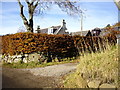
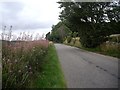
1
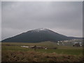
View of Tap O'Noth
From Rhynie-Huntly road near Scurdargue
Image: © Stanley Howe
Taken: 24 Mar 2006
0.03 miles
2
Exit to the Rhynie-Essie road
From the path to Tap O'Noth.
Image: © Stanley Howe
Taken: 3 Nov 2008
0.07 miles
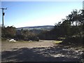
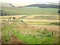
4
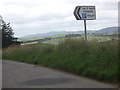
Access to Tap O'Noth car park
From the A941 near Howton.
Image: © Stanley Howe
Taken: 28 Aug 2013
0.08 miles
5
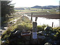
Access to Scurdargue Cottages
Millstone nameplate by Essie road.
Image: © Stanley Howe
Taken: 3 Nov 2007
0.09 miles
7
Access to Tap O'Noth car park
Off Rhynie to Essie road.
Image: © Stanley Howe
Taken: 3 Nov 2008
0.11 miles
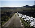
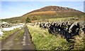
8
The road to the Tap o' Noth car park
The road and car park was entertaining today as compressed snow was thawing, covering everything with wet ice.
Image: © Richard Webb
Taken: 20 Dec 2011
0.12 miles
9
Approach to Scurdargue on A941
From Newseat.
Image: © Stanley Howe
Taken: 28 Aug 2013
0.12 miles
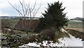
10
Farm track down to Burn of Easaiche
From near Scurdargue farm.
Image: © Stanley Howe
Taken: 28 Aug 2013
0.12 miles