
IMAGES TAKEN NEAR TO
Fyvie, TURRIFF, AB53 8RS
Introduction
This page details the photographs taken nearby to AB53 8RS by members of the Geograph project.
The Geograph project started in 2005 with the aim of publishing, organising and preserving representative images for every square kilometre of Great Britain, Ireland and the Isle of Man.

There are currently over 7.5m images from over14,400 individuals and you can help contribute to the project by visiting https://www.geograph.org.uk
Image Map
Images are licensed for reuse under creativecommons.org/licenses/by-sa/2.0
Notes
- Clicking on the map will re-center to the selected point.
- The higher the marker number, the further away the image location is from the centre of the postcode.
Image Listing (7 Images Found)
Images are licensed for reuse under creativecommons.org/licenses/by-sa/2.0
Image
Details
Distance
1

Hill of Tifty Cottage
A cottage in a shelter belt of tree by the Hill of Tifty.
Image: © Andrew Wood
Taken: 29 Jun 2021
0.01 miles
2

East by Tifty
The minor road by Tifty leading east.
Image: © Andrew Wood
Taken: 29 Jun 2021
0.02 miles
3
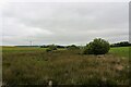
Tifty Wetland
Low lying wetland by the roadside, this is to the south of the Moss of Tifty proper.
Image: © Andrew Wood
Taken: 29 Jun 2021
0.08 miles
4
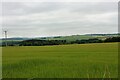
Hill of Tifty Crop
A grain crop growing on the south easterly slopes of the Hill of Tifty.
Image: © Andrew Wood
Taken: 29 Jun 2021
0.14 miles
5
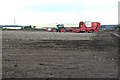
Tattie Lifting
Potato harvesters at work near Tifty.
Image: © Anne Burgess
Taken: 21 Sep 2007
0.14 miles
6
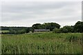
Ruinous Barn
A barn at Whiterashes with serious roofing issues.
Image: © Andrew Wood
Taken: 29 Jun 2021
0.19 miles
7
Tifty Cattle
Cattle grazing on the Hill of Tifty.
Image: © Andrew Wood
Taken: 29 Jun 2021
0.19 miles