
IMAGES TAKEN NEAR TO
TURRIFF, AB53 8EY
Introduction
This page details the photographs taken nearby to AB53 8EY by members of the Geograph project.
The Geograph project started in 2005 with the aim of publishing, organising and preserving representative images for every square kilometre of Great Britain, Ireland and the Isle of Man.

There are currently over 7.5m images from over14,400 individuals and you can help contribute to the project by visiting https://www.geograph.org.uk
Image Map
Images are licensed for reuse under creativecommons.org/licenses/by-sa/2.0
Notes
- Clicking on the map will re-center to the selected point.
- The higher the marker number, the further away the image location is from the centre of the postcode.
Image Listing (7 Images Found)
Images are licensed for reuse under creativecommons.org/licenses/by-sa/2.0
Image
Details
Distance
2
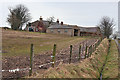
Upper Brownhill
There is a bewildering number of Brownhills along this minor road - Upper, Little, West, Croft and plain Brownhill.
Image: © Anne Burgess
Taken: 27 Feb 2015
0.03 miles
3
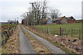
Little Brownhill
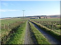
Although the road is shown as a public road, it has grass growing up the middle of it, and the right-hand side of it is collapsing towards the ditch. At least there aren't as many potholes here as in the first section, north of Brownhill.
Image: © Anne Burgess
Taken: 27 Feb 2015
0.11 miles
4
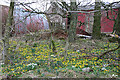
West Brownhill
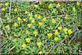
There are lots of places with a carpet of snowdrops, but West Brownhill has the first carpet of Winter Aconites I have come across this year.
Image: © Anne Burgess
Taken: 27 Feb 2015
0.14 miles
5
Winter Aconites
Some of the carpet of these cheerful yellow flowers at Image
Image: © Anne Burgess
Taken: 27 Feb 2015
0.14 miles
7
Drainage Ditch
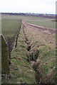
The land here is divided into long narrow strips up and down the slope. This is the march of Upper Brownhill and West Brownhill, marked by both fences and an arrow-straight ditch that drains into the Tifty Burn.
Image: © Anne Burgess
Taken: 27 Feb 2015
0.20 miles