
IMAGES TAKEN NEAR TO
TURRIFF, AB53 8EN
Introduction
This page details the photographs taken nearby to AB53 8EN by members of the Geograph project.
The Geograph project started in 2005 with the aim of publishing, organising and preserving representative images for every square kilometre of Great Britain, Ireland and the Isle of Man.

There are currently over 7.5m images from over14,400 individuals and you can help contribute to the project by visiting https://www.geograph.org.uk
Image Map
Images are licensed for reuse under creativecommons.org/licenses/by-sa/2.0
Notes
- Clicking on the map will re-center to the selected point.
- The higher the marker number, the further away the image location is from the centre of the postcode.
Image Listing (7 Images Found)
Images are licensed for reuse under creativecommons.org/licenses/by-sa/2.0
Image
Details
Distance
1

Howegarden
This company grows and sells organic vegetables, mostly potatoes and carrots. The farm at West Pitdoulzie has been extensively rebuilt to handle the produce.
Image: © Anne Burgess
Taken: 13 Sep 2007
0.13 miles
2

West Pitdoulzie
This is part of the large depot built by Howegarden to handle the produce from its 500 hectares of organic land.
Image: © Anne Burgess
Taken: 13 Sep 2007
0.16 miles
3
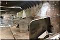
Auld Byre
The disused stalls of the byre at East Pitdoulzie.
Image: © Andrew Wood
Taken: 10 Apr 2016
0.18 miles
4
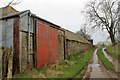
Pitdoulzie Steading
A big barn door and low buildings alongside a muddy track at the largely disused East Pitdoulzie farm.
Image: © Andrew Wood
Taken: 10 Apr 2016
0.19 miles
5
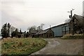
East Pitdoulzie
The approach to the sad and neglected farm of East Pitdoulzie. The farmland is leased out and the corporate owners have little use for the old steading.
Image: © Andrew Wood
Taken: 10 Apr 2016
0.19 miles
6
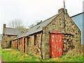
Old Steading
Part of the old steading at East Pitdoulzie.
Image: © Andrew Wood
Taken: 10 Apr 2016
0.21 miles
7

East Pitdoulzie
The farm stands on a low ridge above the road.
Image: © Anne Burgess
Taken: 13 Sep 2007
0.22 miles