
IMAGES TAKEN NEAR TO
TURRIFF, AB53 8DX
Introduction
This page details the photographs taken nearby to AB53 8DX by members of the Geograph project.
The Geograph project started in 2005 with the aim of publishing, organising and preserving representative images for every square kilometre of Great Britain, Ireland and the Isle of Man.

There are currently over 7.5m images from over14,400 individuals and you can help contribute to the project by visiting https://www.geograph.org.uk
Image Map
Images are licensed for reuse under creativecommons.org/licenses/by-sa/2.0
Notes
- Clicking on the map will re-center to the selected point.
- The higher the marker number, the further away the image location is from the centre of the postcode.
Image Listing (6 Images Found)
Images are licensed for reuse under creativecommons.org/licenses/by-sa/2.0
Image
Details
Distance
1
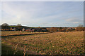
Stubble field southeast of Mill of Colp.
Image: © Des Colhoun
Taken: 7 Jan 2007
0.08 miles
2
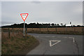
Road Junction
You can tell that I am struggling to find an interesting view in this square. The sign tells drivers (and presumably passengers, navigators and the like) coming on the minor road from Turriff that they have reached the B9170 and that if they turn left they can go to Cuminestown. Apparently it doesn't take them anywhere if they turn right.
Image: © Anne Burgess
Taken: 27 Feb 2015
0.10 miles
4
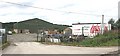
North East Promotions
This rural spot somehow seems a slightly curious place to find a firm hiring out marquees!
Image: © Anne Burgess
Taken: 13 Sep 2007
0.11 miles
5
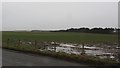
Thawing fields
Thawing of frost and snow is probably the most miserable of water. Latent heat of fusion takes its toll on air temperatures and the cooling forms fogs. Melting snow becomes very slippery ice and it's usually raining, just like today. View across a sodden field towards Wood of Colp.
Image: © Richard Webb
Taken: 21 Dec 2011
0.16 miles
