IMAGES TAKEN NEAR TO
TURRIFF, AB53 8AN
Introduction
This page details the photographs taken nearby to AB53 8AN by members of the Geograph project.
The Geograph project started in 2005 with the aim of publishing, organising and preserving representative images for every square kilometre of Great Britain, Ireland and the Isle of Man.

There are currently over 7.5m images from over14,400 individuals and you can help contribute to the project by visiting https://www.geograph.org.uk
Image Map
Images are licensed for reuse under creativecommons.org/licenses/by-sa/2.0
Notes
- Clicking on the map will re-center to the selected point.
- The higher the marker number, the further away the image location is from the centre of the postcode.
Image Listing (6 Images Found)
Images are licensed for reuse under creativecommons.org/licenses/by-sa/2.0
Image
Details
Distance
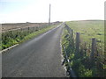
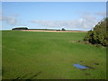
1
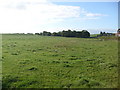
Braefoot
The willows beyond the field mark a damp area, marked as marsh on the older 1:50,000 map, but now just as woodland.
Image: © Anne Burgess
Taken: 13 Sep 2007
0.15 miles
3
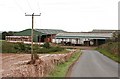
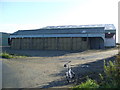
Braefoot
A large steading close to the road.
Image: © Anne Burgess
Taken: 13 Sep 2007
0.18 miles