IMAGES TAKEN NEAR TO
New Deer, TURRIFF, AB53 6TL
Introduction
This page details the photographs taken nearby to AB53 6TL by members of the Geograph project.
The Geograph project started in 2005 with the aim of publishing, organising and preserving representative images for every square kilometre of Great Britain, Ireland and the Isle of Man.

There are currently over 7.5m images from over14,400 individuals and you can help contribute to the project by visiting https://www.geograph.org.uk
Image Map
Images are licensed for reuse under creativecommons.org/licenses/by-sa/2.0
Notes
- Clicking on the map will re-center to the selected point.
- The higher the marker number, the further away the image location is from the centre of the postcode.
Image Listing (5 Images Found)
Images are licensed for reuse under creativecommons.org/licenses/by-sa/2.0
Image
Details
Distance
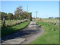
3
Turfhill
A few late daffodils and narcissi by the fields near Turfhill.
Image: © Anne Burgess
Taken: 14 May 2009
0.12 miles
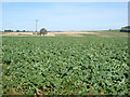
4
NEW
Field near Turfhill
Fors some reason this field is looking dried out rather than green like most of its unploughed neighbours.
Image: © Anne Burgess
Taken: 20 Mar 2025
0.17 miles
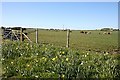
5
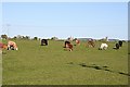
Near Turfhill
Beyond the cattle, the kirk tower and spires in New Deer are just visible on the horizon.
Image: © Anne Burgess
Taken: 14 May 2009
0.22 miles