IMAGES TAKEN NEAR TO
Craigston, TURRIFF, AB53 5RR
Introduction
This page details the photographs taken nearby to AB53 5RR by members of the Geograph project.
The Geograph project started in 2005 with the aim of publishing, organising and preserving representative images for every square kilometre of Great Britain, Ireland and the Isle of Man.

There are currently over 7.5m images from over14,400 individuals and you can help contribute to the project by visiting https://www.geograph.org.uk
Image Map
Images are licensed for reuse under creativecommons.org/licenses/by-sa/2.0
Notes
- Clicking on the map will re-center to the selected point.
- The higher the marker number, the further away the image location is from the centre of the postcode.
Image Listing (6 Images Found)
Images are licensed for reuse under creativecommons.org/licenses/by-sa/2.0
Image
Details
Distance
1
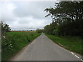
Minor road to Walkerhill and Auchlinn
Image: © David Purchase
Taken: 11 Jun 2019
0.09 miles
2
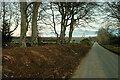
Earth works
Seems like a bit of work going on here to tidy up the road.
Image: © Ralph Greig
Taken: 12 Feb 2023
0.18 miles
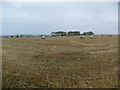
3
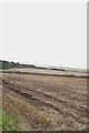
Ploughing near Moreless
The driver of this tractor would not have been as concerned as I to see the view across the fields here fade into the misty curtain of an approaching squall of rain. I only just got the photograph before the camera got wet.
Image: © Anne Burgess
Taken: 21 Sep 2007
0.19 miles
6
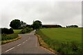
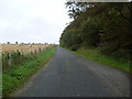
South Mains of Craigston
South Mains, seen on its slip road off the B9105.
Image: © Andrew Wood
Taken: 29 Jun 2021
0.21 miles