IMAGES TAKEN NEAR TO
TURRIFF, AB53 4NF
Introduction
This page details the photographs taken nearby to AB53 4NF by members of the Geograph project.
The Geograph project started in 2005 with the aim of publishing, organising and preserving representative images for every square kilometre of Great Britain, Ireland and the Isle of Man.

There are currently over 7.5m images from over14,400 individuals and you can help contribute to the project by visiting https://www.geograph.org.uk
Image Map
Images are licensed for reuse under creativecommons.org/licenses/by-sa/2.0
Notes
- Clicking on the map will re-center to the selected point.
- The higher the marker number, the further away the image location is from the centre of the postcode.
Image Listing (10 Images Found)
Images are licensed for reuse under creativecommons.org/licenses/by-sa/2.0
Image
Details
Distance
1
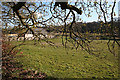
Knockiemill Cottage
Screened by the branches of roadside trees, Knockiemill Cottage stands close to a sharp meander of the River Deveron.
Image: © Anne Burgess
Taken: 1 May 2013
0.02 miles
2
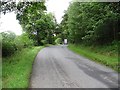
Minor road, Knockiemill
The lorry is heading for an industrial site a wee bit further north (wind farmers!) After that the road was quiet.
Image: © Richard Webb
Taken: 5 Aug 2011
0.04 miles
3
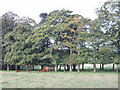
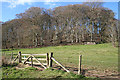
Cattle and trees by Knockiemill Cottages
View from road. The belt of trees runs down to the River Deveron.
Image: © David Hawgood
Taken: 13 Sep 2007
0.04 miles
4
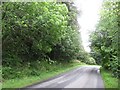
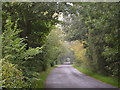
Minor road, Knockiemill
Road heading towards Turriff having followed the Deveron upstream.
Image: © Richard Webb
Taken: 5 Aug 2011
0.12 miles
5
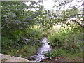
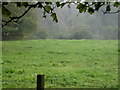
Field at Knockiemill
The slope up from the haugh lands by the River Deveron. There was a lively stallion in this field, but he wouldn't stay in the viewfinder. Must have been camera-shy.
Image: © Anne Burgess
Taken: 1 May 2013
0.17 miles
8
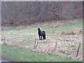
Horse at Knockiemill
Single horse in a field by the roadside to the north of Knockiemill.
Image: © Scott Cormie
Taken: 16 Apr 2022
0.20 miles
10
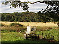
Fields by Knockiemill, Turriff
Pasture in the foreground, with the water tank on the trailer looking like ones used at fish farms. Straw bales beyond, then woods beyond the River Deveron. View from road, which is part of National Cycle Network route 1 from Dover to John o'Groats and on to Orkney and Shetland.
Image: © David Hawgood
Taken: 13 Sep 2007
0.24 miles