IMAGES TAKEN NEAR TO
Westfield Road, TURRIFF, AB53 4AF
Introduction
This page details the photographs taken nearby to Westfield Road, AB53 4AF by members of the Geograph project.
The Geograph project started in 2005 with the aim of publishing, organising and preserving representative images for every square kilometre of Great Britain, Ireland and the Isle of Man.

There are currently over 7.5m images from over14,400 individuals and you can help contribute to the project by visiting https://www.geograph.org.uk
Image Map
Images are licensed for reuse under creativecommons.org/licenses/by-sa/2.0
Notes
- Clicking on the map will re-center to the selected point.
- The higher the marker number, the further away the image location is from the centre of the postcode.
Image Listing (6 Images Found)
Images are licensed for reuse under creativecommons.org/licenses/by-sa/2.0
Image
Details
Distance
1
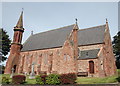
St Congan's episcopal church, Turriff
Built 1862 in the popular (at the time) pseudo Early English style. The "space rocket" spirelet resembles that at Old Meldrum: http://www.geograph.org.uk/photo/4989356 . C-listed (LB42181): http://portal.historicenvironment.scot/designation/LB42181 .
Image: © Bill Harrison
Taken: 17 Sep 2016
0.20 miles
2
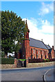
St Congan's Church
This red sandstone church was built by William Ramage in 1862. The ruins of the much older St Congan’s Church lie approximately 0.3km south-east.
It is a Category C(S) Listed Building.
Image: © Alex Silver
Taken: 10 Oct 2010
0.21 miles
4
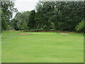
Turriff Golf Club, 14th Hole, Mill
The fourteenth hole at Turriff, looking to the green.
Image: © Scott Cormie
Taken: 4 Aug 2021
0.21 miles
5
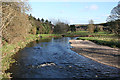
River Deveron
The view upstream from the Deveron Bridge on the B9025. I do not recommend walking across the bridge; there is no provision for pedestrians and the line of sight for motorists is restricted, especially coming from Turriff.
Image: © Anne Burgess
Taken: 1 May 2013
0.24 miles