IMAGES TAKEN NEAR TO
Beechcroft Avenue, INSCH, AB52 6WD
Introduction
This page details the photographs taken nearby to Beechcroft Avenue, AB52 6WD by members of the Geograph project.
The Geograph project started in 2005 with the aim of publishing, organising and preserving representative images for every square kilometre of Great Britain, Ireland and the Isle of Man.

There are currently over 7.5m images from over14,400 individuals and you can help contribute to the project by visiting https://www.geograph.org.uk
Image Map
Images are licensed for reuse under creativecommons.org/licenses/by-sa/2.0
Notes
- Clicking on the map will re-center to the selected point.
- The higher the marker number, the further away the image location is from the centre of the postcode.
Image Listing (5 Images Found)
Images are licensed for reuse under creativecommons.org/licenses/by-sa/2.0
Image
Details
Distance
1
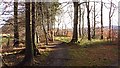
Strip wood, Insch
One of the strip woods associated with Drumrossie House. Now on the edge of Insch.
Image: © Richard Webb
Taken: 22 Dec 2011
0.16 miles
2
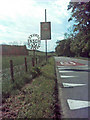
Insch sign
An old sign for the village of Insch.
Image: © Andrew Stuart
Taken: 31 May 2007
0.18 miles
3
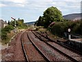
Railway Line from Insch Station Looking East
Image: © Gilbert Scott
Taken: 31 Jul 2007
0.21 miles
4
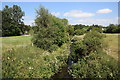
View of the Shevock
The burn that runs through Insch has the unusual name of the Shevock and joins the River Urie a few km to the east. A footbridge now crosses it to access new housing developments to the south of the burn. According to Celtic Placenames in Aberdeenshire by John Milne, 'shevock' means 'placid little burn'.
Image: © Bill Harrison
Taken: 7 Jul 2018
0.23 miles