
IMAGES TAKEN NEAR TO
Leslie, INSCH, AB52 6NS
Introduction
This page details the photographs taken nearby to AB52 6NS by members of the Geograph project.
The Geograph project started in 2005 with the aim of publishing, organising and preserving representative images for every square kilometre of Great Britain, Ireland and the Isle of Man.

There are currently over 7.5m images from over14,400 individuals and you can help contribute to the project by visiting https://www.geograph.org.uk
Image Map
Images are licensed for reuse under creativecommons.org/licenses/by-sa/2.0
Notes
- Clicking on the map will re-center to the selected point.
- The higher the marker number, the further away the image location is from the centre of the postcode.
Image Listing (5 Images Found)
Images are licensed for reuse under creativecommons.org/licenses/by-sa/2.0
Image
Details
Distance
1
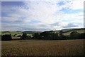
Looking Down on Leslie
A view over a wheat field to Old Leslie.
Image: © Andrew Wood
Taken: 24 Aug 2011
0.03 miles
2
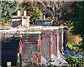
Dormers in line
Only the tall dormer windows of this row of cottages are visible above the fence along the road.
Image: © Anne Burgess
Taken: 3 Nov 2015
0.06 miles
3
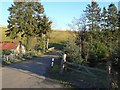
Wooded junction
Road junction between Braehead and Old Leslie.
Image: © James Allan
Taken: 1 Dec 2006
0.08 miles
4

Junction at Old Leslie
The road to the right will take you on a nice 2 1/2 mile journey to Insch, straight on an equally delightful journey to Kennethmont.
Image: © Andrew Stuart
Taken: 7 Jun 2007
0.10 miles
5

Grain Fields
Fields of ripening grain and a view to distant Bennachie.
Image: © Andrew Wood
Taken: 24 Aug 2011
0.21 miles