
IMAGES TAKEN NEAR TO
High Street, INSCH, AB52 6JF
Introduction
This page details the photographs taken nearby to High Street, AB52 6JF by members of the Geograph project.
The Geograph project started in 2005 with the aim of publishing, organising and preserving representative images for every square kilometre of Great Britain, Ireland and the Isle of Man.

There are currently over 7.5m images from over14,400 individuals and you can help contribute to the project by visiting https://www.geograph.org.uk
Image Map
Images are licensed for reuse under creativecommons.org/licenses/by-sa/2.0
Notes
- Clicking on the map will re-center to the selected point.
- The higher the marker number, the further away the image location is from the centre of the postcode.
Image Listing (46 Images Found)
Images are licensed for reuse under creativecommons.org/licenses/by-sa/2.0
Image
Details
Distance
1
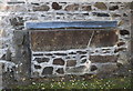
Radulfus stone, Insch
The grave-slab was found buried in the kirkyard in the 19th Century. The very worn inscription to Radulfus, a 12th Century priest, can just be discerned. For more, see Epitaphs and Inscriptions from Burial Grounds and Old Buildings... by Alexander Jervise, vol. 1. p. 20 (available as a free download from archive.org).
Image: © Bill Harrison
Taken: 7 Jul 2018
0.02 miles
2

Granite Gravestone
An elaborataly carved memorial in the old kirkyard of Insch.
Image: © Anne Burgess
Taken: 24 Mar 2026
0.02 miles
3
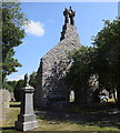
Insch old kirk
Only the gable end and bellcote remain of the kirk remain, probably built in 1769. The fine renaissance bellcote (dated 1613) must come from an earlier church on the same site. The kirk fell into ruin after the replacement church on Western Road was built in 1883. C-listed (LB9065): http://portal.historicenvironment.scot/designation/LB9065 .
Image: © Bill Harrison
Taken: 7 Jul 2018
0.03 miles
4
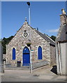
Insch masonic hall
Originally a Congregational chapel dating from ca. 1860.
Image: © Bill Harrison
Taken: 7 Jul 2018
0.03 miles

6
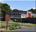
Insch fire station
Built on the site of the free kirk.
Image: © Bill Harrison
Taken: 7 Jul 2018
0.04 miles
7

Aberdeen Town and Country Bank
Built in 1867 to a design by William Smith, the bank features a Dric portico and a fine three-light window to its left. The building is Category B Listed. See https://www.trove.scot/designation/LB9066 for details. Later it became the Insch Savings Bank.
Image: © Anne Burgess
Taken: 24 Mar 2026
0.05 miles
8
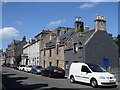
High Street, Insch
The main street in the large village (or small town?) of Insch.
Image: © Bill Harrison
Taken: 7 Jul 2018
0.05 miles
9
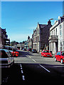
Insch Village
Some of the shops & the bank in the village of Insch.
Image: © Andrew Stuart
Taken: 31 May 2007
0.05 miles
10
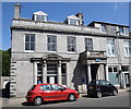
TSB, High Street, Insch
Still open in 2018 and built as the Aberdeen Town and County Bank in 1867 and B-listed (LB9066): http://portal.historicenvironment.scot/designation/LB9066 . Note the fine porch.
Image: © Bill Harrison
Taken: 7 Jul 2018
0.06 miles