IMAGES TAKEN NEAR TO
Midmar, INVERURIE, AB51 7ND
Introduction
This page details the photographs taken nearby to AB51 7ND by members of the Geograph project.
The Geograph project started in 2005 with the aim of publishing, organising and preserving representative images for every square kilometre of Great Britain, Ireland and the Isle of Man.

There are currently over 7.5m images from over14,400 individuals and you can help contribute to the project by visiting https://www.geograph.org.uk
Image Map
Images are licensed for reuse under creativecommons.org/licenses/by-sa/2.0
Notes
- Clicking on the map will re-center to the selected point.
- The higher the marker number, the further away the image location is from the centre of the postcode.
Image Listing (9 Images Found)
Images are licensed for reuse under creativecommons.org/licenses/by-sa/2.0
Image
Details
Distance
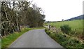
1
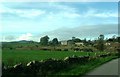
Upstream Bethlin Burn
Seen from a minor road over the burn. School Croft on extreme right.
Image: © Stanley Howe
Taken: 27 Oct 2017
0.04 miles
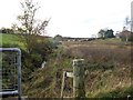
2
Bridge over Bethlin Burn
On minor road between Newton of Corsindae and Migvie Kirk.
Image: © Stanley Howe
Taken: 27 Oct 2017
0.07 miles
3
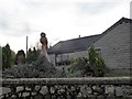
Sculpted Owl
Carved from wood; in the garden of 'Drogheda' at Newton of Corsindae.
Image: © Stanley Howe
Taken: 27 Oct 2017
0.09 miles
4
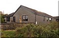
'Drogheda', Newton of Corsindae
With a wooden sculpted Buzzard in the front garden.
Image: © Stanley Howe
Taken: 27 Oct 2017
0.09 miles
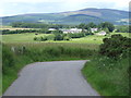
7
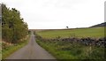
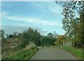
Road from near Bethlin junction towards Bogindhu junction
Fields to right, a wood to left.
Image: © Stanley Howe
Taken: 27 Oct 2017
0.16 miles