IMAGES TAKEN NEAR TO
Wilson Place, INVERURIE, AB51 5QN
Introduction
This page details the photographs taken nearby to Wilson Place, AB51 5QN by members of the Geograph project.
The Geograph project started in 2005 with the aim of publishing, organising and preserving representative images for every square kilometre of Great Britain, Ireland and the Isle of Man.

There are currently over 7.5m images from over14,400 individuals and you can help contribute to the project by visiting https://www.geograph.org.uk
Image Map
Images are licensed for reuse under creativecommons.org/licenses/by-sa/2.0
Notes
- Clicking on the map will re-center to the selected point.
- The higher the marker number, the further away the image location is from the centre of the postcode.
Image Listing (5 Images Found)
Images are licensed for reuse under creativecommons.org/licenses/by-sa/2.0
Image
Details
Distance
1
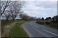
Orphaned road, Kemnay
A site on the edge of the village awaits development.
Image: © Richard Webb
Taken: 5 Apr 2017
0.11 miles
2
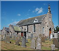
Kemnay parish kirk
Built ca. 1844 and C-listed: http://portal.historicenvironment.scot/designation/LB9207 .
Image: © Bill Harrison
Taken: 26 Jun 2016
0.12 miles
3
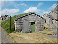
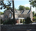
Morthouse, Kemnay parish kirk
Morthouses are a feature of the villages close to Aberdeen, St Andrews and Glasgow: http://www.abdn.ac.uk/bodysnatchers/morthouses.php .
This one from ca. 1830 is B-listed: http://portal.historicenvironment.scot/designation/LB9208 .
Image: © Bill Harrison
Taken: 26 Jun 2016
0.13 miles