1
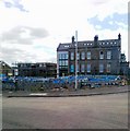
New housing, Inverurie
Image: © Alex McGregor
Taken: 15 Jun 2011
0.01 miles
2
Manager?s Office and Drawing Office, Inverurie railway works
Early 20th century, built as part of the new works of the Great North of Scotland Railway. Designed by William Pickersgill, Listed Category B.
Image: © Alan Murray-Rust
Taken: 22 May 2022
0.02 miles
3
Former Drawing Office for Inverurie Loco Works
Derelict for 40 years since the works closed in 1969, now being restored. B-listed: http://www.britishlistedbuildings.co.uk/sc-49302-former-manager-s-drawing-office-former-gr
Image: © Bill Harrison
Taken: 19 Aug 2012
0.03 miles
4
Former foundry and smithy, GNSR railway works, Inverurie
The Great North of Scotland Railway moved its railway works from a cramped site at Kittybrewster, Aberdeen, to Inverurie, creating a modern facility which opened in 1900. This is one of the few remaining buildings, which had become partly ruined but is currently under renovation for residential use. It is Listed Category B.
Image: © Alan Murray-Rust
Taken: 22 May 2022
0.05 miles
5
Paper Roller
This cylinder was part of one of the paper machines in Thomas Tait's paper mills, once an important employer in Inverurie. It has a mass of 30 tonnes, and is made of polished granite. An information board says that the granite was sourced in Finland because it has a higher silica content than the local granites. This makes sense because the other common minerals in granite, such as mica and feldspar, are less resistant to erosion than quartz, which is almost pure silica. These minerals would wear out of the surface and create pocks and thus unevenness on the surface of the roller.
Image: © Anne Burgess
Taken: 22 May 2022
0.05 miles
6
6 & 7 Harlaw Road, Inverurie
A very typical Scottish 4-dwelling block (2-up, 2-down), built in local granite and sandstone. The original open outside staircase to the upper flat has been enclosed in recent years. The porch includes some fine decorative cast iron https://www.geograph.org.uk/photo/7183973
Image: © Alan Murray-Rust
Taken: 22 May 2022
0.06 miles
7
6 & 7 Harlaw Road, Inverurie
Detail showing the cast iron valance to the porch canopy. See https://www.geograph.org.uk/photo/7183972 for location
Image: © Alan Murray-Rust
Taken: 22 May 2022
0.06 miles
8
Suburban corner, Inverurie
The meeting point of Garioch Road and Mortimer's Lane with Harlaw Road.
Image: © Bill Harrison
Taken: 19 Aug 2012
0.07 miles
9
Former Smithy, Furnace and Foundry Shop, Inverurie railway works
One of the few surviving buildings, in poor condition but currently undergoing renovation as residential. Listed Category B.
Image: © Alan Murray-Rust
Taken: 22 May 2022
0.07 miles
10
Former Smithy and Foundry
These, with the carriage shed, are the only surviving buildings of the locomotive works. Like the carriage shed they are being renovated and converted to housing.
Image: © Anne Burgess
Taken: 22 May 2022
0.07 miles


