IMAGES TAKEN NEAR TO
Polinar Place, INVERURIE, AB51 3YZ

Introduction

This page details the photographs taken nearby to Polinar Place, AB51 3YZ by members of the Geograph project.

The Geograph project started in 2005 with the aim of publishing, organising and preserving representative images for every square kilometre of Great Britain, Ireland and the Isle of Man.

There are currently over 7.5m images from over14,400 individuals and you can help contribute to the project by visiting https://www.geograph.org.uk

Image Map


Images are licensed for reuse under creativecommons.org/licenses/by-sa/2.0
Notes
  • Clicking on the map will re-center to the selected point.
  • The higher the marker number, the further away the image location is from the centre of the postcode.

Image Listing (12 Images Found)

Images are licensed for reuse under creativecommons.org/licenses/by-sa/2.0
Image
Details
Distance
1
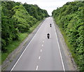
Bikers on the A96
The long-term plan is for a dual-carriageway all the way from Aberdeen to Inverness.
Image: © Bill Harrison Taken: 24 Jun 2020
0.11 miles
2
Inverurie Golf Course, 5th Hole, Brigadoon
The long fifth hole at Inverurie, looking down the hill to the green.
Image: © Scott Cormie Taken: 24 Jul 2019
0.14 miles
3
Inverurie hospital
Built 1940 in 'International Modernist' style (https://en.wikipedia.org/wiki/International_Style_(architecture) ). Several of the buildings are B-listed including the administration block in the left-centre of the picture (LB13320: http://portal.historicenvironment.scot/designation/LB13320 ).
Image: © Bill Harrison Taken: 3 Mar 2019
0.14 miles
4
Former ward block, Inverurie Hospital
The complex was built 1936-40 as an infectious disease hospital for Aberdeenshire in the 'International Modern' style. Several of the striking buildings have individual listed status.
Image: © Bill Harrison Taken: 24 Jun 2020
0.15 miles
5
Minor Road across the A96 at Inverurie
Image: © David Robinson Taken: 30 Jul 2019
0.15 miles
6
A96 flyover
Looking down on the main route from Aberdeen to Inverness. Taken on a flyover close to the town of Inverurie
Image: © Ralph Greig Taken: 12 Nov 2021
0.17 miles
7
Kellands Primary School, Inverurie
School roll (2020): 440 plus 80 nursery places.
Image: © Bill Harrison Taken: 24 Jun 2020
0.18 miles
8
Tree Belt
A shelter belt of trees in front of relatively new housing by the Inverurie bypass.
Image: © Andrew Wood Taken: 14 May 2016
0.23 miles
9
Inverurie Golf Course, 6th Hole, Warslin Lee
The sixth hole at Inverurie, looking to the green.
Image: © Scott Cormie Taken: 24 Jul 2019
0.24 miles
10
Don Islet
small island in the Don just downstream from the A96 road bridge.
Image: © Andrew Wood Taken: 31 Oct 2015
0.25 miles