1
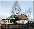
Kintore by-pass (the A96)
Pretty quiet on a Sunday morning.
Image: © Bill Harrison
Taken: 19 Feb 2017
0.05 miles
2
Single-storey cottages, Forest Road, Kintore
Image: © Bill Harrison
Taken: 19 Feb 2017
0.12 miles
3
Teacup Planter
There a few interesting objects in this little garden at the junction of the B987 and Lochburn Drive, including some Teacup Planters.
Image: © Angela Jones
Taken: 2 Aug 2024
0.16 miles
4
Kintore By-Pass from Forest Road Bridge
Image: © Harry Leil
Taken: 5 Jan 2009
0.17 miles
5
Old milemarker by the B987, Northern Road, Kintore
Milemarker formerly by the Aberdeenshire Canal, in parish of Kintore (District), Bridgend (Bridgealehouse), Northern Road, Kintore, right hand side of garden, next to large tree.
Inscription reads:-
15
(To Aberdeen - by canal)
HES Scheduled Ancient Monument: 7676
http://portal.historicenvironment.scot/designation/LB49868
Surveyed
Milestone Society National ID: ABE-15
Image: © Milestone Society
Taken: Unknown
0.17 miles
6
Station Garage, Kintore
The last building in the village. There were probably petrol pumps when it was on the main Aberdeen to Inverness road, but it now specialises in servicing and repairs.
Image: © Bill Harrison
Taken: 19 Feb 2017
0.17 miles
7
Kintore houses
Image: © Bill Harrison
Taken: 7 Aug 2022
0.19 miles
8
Former Masonic hall, Kintore
Now apparently housing; 1919 on the date-stone.
Image: © Bill Harrison
Taken: 19 Feb 2017
0.21 miles
9
Kintore Co-Op
The village convenience store.
Image: © Bill Harrison
Taken: 19 Feb 2017
0.21 miles
10
Former Station Hotel, Kintore
This imposing granite structure has 1899 on the date-stone; the station (closed in 1968, but proposed to reopen as part of the Inverness-Aberdeen line update) was just behind the building. Now flats. Note ashlar granite to the front and rougher blocks to the side.
Image: © Bill Harrison
Taken: 19 Feb 2017
0.23 miles


